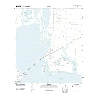
2010 Map of Point Comfort
USGS Topo · Published 2010About this map
The industrial and coastal interface of Point Comfort and Port Lavaca dominates this 2010 topographic study, where the Lavaca River meets the expansive Lavaca Bay. The landscape is heavily defined by large-scale water management and industrial infrastructure, notably the Swan Lake Oil Field and a complex series of embankments including the Storm Lake Levee and Evaporation Lake Dam. These features illustrate the area's role in resource extraction and coastal engineering at the edge of the Gulf of Mexico.
Find a feature on this map
31 named features on this map. Tap any name to fly to it.
Don’t see what you’re looking for? This feature index may not catch every label — zoom into the map to look around manually.
Map Details
Editions of this 2010 Point Comfort Map
This is the sole edition of this map. No revisions or reprints were ever made.
Other maps of this area

1951 · Keller Bay
USGS Topo · 1:24,000

1952 · Port Lavaca East
USGS Topo · 1:24,000

1952 · Point Comfort
USGS Topo · 1:24,000

1952 · Olivia
USGS Topo · 1:24,000

1952 · Kamey
USGS Topo · 1:24,000

1952 · Port Lavaca West
USGS Topo · 1:24,000

1952 · La Salle
USGS Topo · 1:24,000

1952 · La Ward
USGS Topo · 1:24,000

1952 · Lolita
USGS Topo · 1:24,000

1953 · Beeville
USGS Topo · 1:250,000