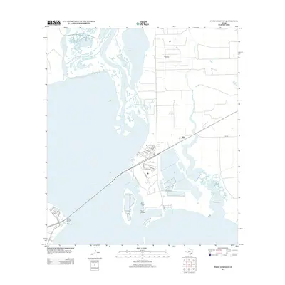
2013 Map of Point Comfort
USGS Topo · Published 2013About this map
Point Comfort occupies a prominent position on the eastern shore of Lavaca Bay, defined by its industrial footprint and coastal geography. This 2013 survey illustrates the complex water management system supporting local industry, featuring the Storm Lake, Raw Water Lake, and Clear Lake basins adjacent to the Coxs Cr Reservoir. The landscape is a mix of navigable waterways and resource extraction, with the Swam Lake Oil Field situated north of the city near the winding course of Cox Cr.
Find a feature on this map
39 named features on this map. Tap any name to fly to it.
Don’t see what you’re looking for? This feature index may not catch every label — zoom into the map to look around manually.
Map Details
Editions of this 2013 Point Comfort Map
This is the sole edition of this map. No revisions or reprints were ever made.
Other maps of this area

1951 · Keller Bay
USGS Topo · 1:24,000

1952 · Port Lavaca East
USGS Topo · 1:24,000

1952 · Point Comfort
USGS Topo · 1:24,000

1952 · Olivia
USGS Topo · 1:24,000

1952 · Kamey
USGS Topo · 1:24,000

1952 · Port Lavaca West
USGS Topo · 1:24,000

1952 · La Salle
USGS Topo · 1:24,000

1952 · La Ward
USGS Topo · 1:24,000

1952 · Lolita
USGS Topo · 1:24,000

1953 · Beeville
USGS Topo · 1:250,000