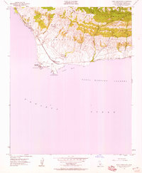
1953 Map of Point Conception
USGS Topo · Published 1959About this map
Point Conception dominates this coastal landscape where the Pacific Ocean meets the Santa Barbara Channel. The western edge of the Santa Ynez Mountains drops toward the sea, marked by land grants like Nuestra Señora and San Julian. Human presence is concentrated along the narrow coastal shelf, anchored by the Lighthouse and the nearby Coast Guard Reservation. The Southern Pacific railroad hugs the shoreline, passing through small points of activity such as Concepcion and the Cojo Ranch. Numerous springs and seasonal drainages, including Cañada del Cojo and Cañada del Cementerio, cut through the terrain. This mid-century view shows a largely undeveloped stretch of the California coast before modern infrastructure expansion, preserving the isolated character of places like Jalama and Gato.
Find a feature on this map
29 named features on this map. Tap any name to fly to it.
Don’t see what you’re looking for? This feature index may not catch every label — zoom into the map to look around manually.
Map Details
Editions of this 1953 Point Conception Map
4 editions found
Other maps of this area

1905 · Guadalupe
USGS Topo · 1:125,000

1905 · Lompoc
USGS Topo · 1:125,000

1942 · Point Arguello
USGS Topo · 1:62,500

1942 · Guadalupe
USGS Topo · 1:125,000

1942 · Lompoc
USGS Topo · 1:125,000

1942 · Lompoc
USGS Topo · 1:62,500

1942 · Pt. Conception
USGS Topo · 1:62,500

1943 · Lompoc
USGS Topo · 1:125,000
1947 · Santa Rosa Hills
USGS Topo · 1:24,000
1947 · El Tranquillon
USGS Topo · 1:24,000