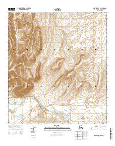
2014 Map of Point Hope B-1 SW
USGS Topo · Published 2014About this map
Sakpik Mountain and Angmakrok Mountain anchor the western portion of this Arctic landscape, where high elevations give way to the broad Saligvik Valley. This 2014 survey by the U.S. Geological Survey illustrates a complex drainage system within the North Slope Borough, dominated by the winding course of the Kukpuk River. The terrain is characterized by the confluence of numerous watercourses, including the Kakpeyak River and the small, north-flowing Angmakrok Cr. To the east, the topography softens into the South Maktak Hills. This map represents the remote wilderness of Alaska's northern coast, where the landscape is defined by its hydrology and mountain peaks rather than human infrastructure or permanent settlements, providing an essential record of the region's physical geography in the early twenty-first century.
Find a feature on this map
15 named features on this map. Tap any name to fly to it.
Don’t see what you’re looking for? This feature index may not catch every label — zoom into the map to look around manually.
Map Details
Editions of this 2014 Point Hope B-1 SW Map
This is the sole edition of this map. No revisions or reprints were ever made.
Other maps of this area

1952 · Point Hope
USGS Topo · 1:250,000

1952 · Point Hope A-2
USGS Topo · 1:63,360

1955 · Point Hope
USGS Topo · 1:250,000

1955 · Point Hope A-1
USGS Topo · 1:63,360

1955 · Point Hope B-1
USGS Topo · 1:63,360

1955 · Point Hope B-2
USGS Topo · 1:63,360

1965 · Point Hope
USGS Topo · 1:250,000
2014 · Point Hope A-1 NW
USGS Topo · 1:25,000
2014 · Point Hope B-1 NE
USGS Topo · 1:25,000
2014 · Point Hope B-2 SE
USGS Topo · 1:25,000