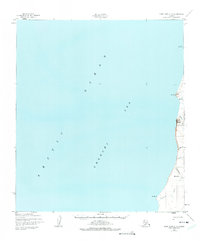
1952 Map of Point Hope C-3
USGS Topo · Published 1975About this map
The Arctic Ocean Chukchi Sea dominates this coastal survey, where the terrestrial world is a narrow strip of northwestern Alaska. Compiled from 1952 aerial photography, the landscape is defined by its dramatic relationship with the water, featuring prominent coastal landmarks like Cape Dyer and Cape Lewis. Rising sharply from the shoreline, Iviangik (Big Ear) Mountain serves as a massive navigational beacon for the region. Numerous drainages, including Siniktaneyak Creek and Kapaloak Cr, cut through the terrain to reach the sea. The mapping represents a moment when photogrammetric methods were beginning to capture these remote coastlines with new precision, documenting the reach of the Kilikralik Creek near Kilikralik Pt before modern environmental shifts altered the northern shores.
Find a feature on this map
12 named features on this map. Tap any name to fly to it.
Don’t see what you’re looking for? This feature index may not catch every label — zoom into the map to look around manually.
Map Details
Editions of this 1952 Point Hope C-3 Map
2 editions found
Other maps of this area

1952 · Point Hope
USGS Topo · 1:250,000

1952 · Point Hope B-3
USGS Topo · 1:63,360
1952 · Point Hope C-3
USGS Topo · 1:63,360

1952 · Point Hope D-2
USGS Topo · 1:63,360

1955 · Point Hope
USGS Topo · 1:250,000

1955 · Point Hope C-2
USGS Topo · 1:63,360

1955 · Point Hope B-2
USGS Topo · 1:63,360

1965 · Point Hope
USGS Topo · 1:250,000
2014 · Point Hope D-2 OE W SE
USGS Topo · 1:25,000
2014 · Point Hope C-3 NE
USGS Topo · 1:25,000