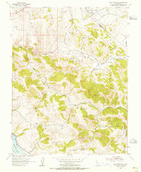
1954 Map of Point Reyes NE
USGS Topo · Published 1955About this map
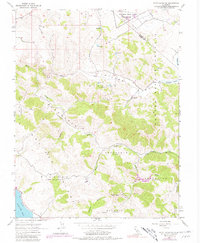
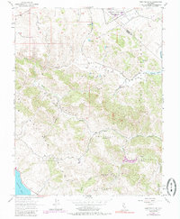
San Antonio Valley and the surrounding rangelands of northern Marin County define this mid-century topographic record. The landscape is marked by numerous historic land divisions, many bearing dual names such as Nicasio (Halleck) and Soulajule (Brackett). These labels reflect the complex history of early California land grants, particularly the Nicasio and Soulajule ranchos, which were further subdivided into smaller holdings like Soulajule (Gormley) and Nicasio (Frink and Reynolds). The northern edge features the Military Res at Two Rock Ranch Station, established for communications and defense. Water remains a central theme across these coastal hills, with the course of Walker Creek winding through the terrain and the presence of Laguna Lake near the Sonoma-Marin border. Significant peaks, including the prominent Three Peaks, rise above the drainages of Chileno Creek and Salmon Creek, leading down toward the eastern shore of Tomales Bay.
Find a feature on this map
25 named features on this map. Tap any name to fly to it.
Don’t see what you’re looking for? This feature index may not catch every label — zoom into the map to look around manually.
Map Details
Editions of this 1954 Point Reyes NE Map
6 editions found
Other maps of this area

1914 · Petaluma
USGS Topo · 1:62,500

1916 · Santa Rosa
USGS Topo · 1:62,500

1916 · Point Reyes
USGS Topo · 1:48,000

1918 · Point Reyes
USGS Topo · 1:62,500

1935 · Sebastopol
USGS Topo · 1:48,000

1942 · Sebastopol
USGS Topo · 1:62,500

1942 · Petaluma
USGS Topo · 1:62,500

1944 · Santa Rosa
USGS Topo · 1:62,500

1947 · Santa Rosa
USGS Topo · 1:250,000

1949 · Santa Rosa
USGS Topo · 1:250,000