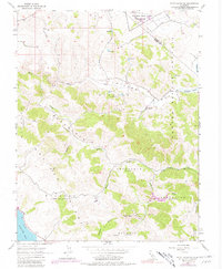
1954 Map of Point Reyes NE
USGS Topo · Published 1980About this map
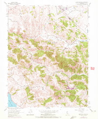
The Two Rock Ranch Station Military Res sits at the northern edge of this Marin County landscape, a region defined by ranching land divisions and rolling ridges. The map meticulously documents the complex land ownership patterns through parenthetical labels like Nicasio (Halleck), Soulajule (Vasquez), and Soulajule (Gormley), reflecting the legacy of Spanish and Mexican land grants. To the west, the reach of Tomales Bay begins to influence the terrain, while the drainage of Walker Creek and Chileno Creek carves through the hills. This 1954 survey, with its 1971 revisions, highlights the reliance on water management in the San Antonio Valley, marked by numerous unnamed reservoirs and the sprawling Laguna Lake. The terrain is punctuated by distinctive high points such as Three Peaks and the Nicasio (Frink and Reynolds) Ridge, offering a detailed view of the coastal range before modern development altered the rural character of this ranching corridor.
Find a feature on this map
25 named features on this map. Tap any name to fly to it.
Don’t see what you’re looking for? This feature index may not catch every label — zoom into the map to look around manually.
Map Details
Editions of this 1954 Point Reyes NE Map
6 editions found
Other maps of this area

1914 · Petaluma
USGS Topo · 1:62,500

1916 · Santa Rosa
USGS Topo · 1:62,500

1916 · Point Reyes
USGS Topo · 1:48,000

1918 · Point Reyes
USGS Topo · 1:62,500

1935 · Sebastopol
USGS Topo · 1:48,000

1942 · Sebastopol
USGS Topo · 1:62,500

1942 · Petaluma
USGS Topo · 1:62,500

1944 · Santa Rosa
USGS Topo · 1:62,500

1947 · Santa Rosa
USGS Topo · 1:250,000

1949 · Santa Rosa
USGS Topo · 1:250,000