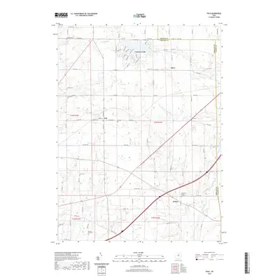
2019 Map of Polk
USGS Topo · Published 2019About this map
The Cinnamon Lake residential development and its namesake reservoir dominate the northern landscape of this region, providing a modern contrast to the surrounding rural townships. Central to this map is the village of Polk, where the intersection of W Congress St and N Main St serves as a local hub. The area is defined by the winding course of the Muddy Fork, which flows toward the southeastern corner, and the smaller drainages of Wolf Run and Katotawa Cr.
Find a feature on this map
62 named features on this map. Tap any name to fly to it.
Don’t see what you’re looking for? This feature index may not catch every label — zoom into the map to look around manually.
Map Details
Editions of this 2019 Polk Map
This is the sole edition of this map. No revisions or reprints were ever made.
Other maps of this area

1904 · Wellington
USGS Topo · 1:62,500

1906 · Wellington
USGS Topo · 1:62,500

1906 · West Salem
USGS Topo · 1:62,500

1908 · Ashland
USGS Topo · 1:62,500

1908 · West Salem
USGS Topo · 1:62,500

1908 · New London
USGS Topo · 1:62,500

1950 · Marion
USGS Topo · 1:250,000

1956 · Toledo
USGS Topo · 1:250,000

1960 · Nova
USGS Topo · 1:24,000

1961 · Toledo
USGS Topo · 1:250,000