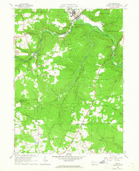
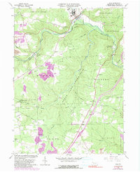
1963 Map of Polk
USGS Topo · Published 1965About this map
The Pennsylvania State Hospital and School grounds occupy the northern edge of this Venango County landscape, situated where French Creek and Sandy Creek converge near the borough of Polk. The industrial character of the mid-20th century is evident in the dense concentration of oil wells near Raymilton and scattered gas wells throughout the Mineral and Victory townships.
Find a feature on this map
49 named features on this map. Tap any name to fly to it.
Don’t see what you’re looking for? This feature index may not catch every label — zoom into the map to look around manually.
Map Details
Editions of this 1963 Polk Map
5 editions found
Other maps of this area

1909 · Franklin
USGS Topo · 1:62,500

1910 · Hilliards
USGS Topo · 1:62,500

1911 · Franklin
USGS Topo · 1:62,500

1911 · Stoneboro
USGS Topo · 1:62,500

1912 · Hilliards
USGS Topo · 1:62,500

1913 · Stoneboro
USGS Topo · 1:62,500

1913 · Mercer
USGS Topo · 1:62,500

1939 · Mercer
USGS Topo · 1:62,500

1943 · Mercer
USGS Topo · 1:62,500

1943 · Stoneboro
USGS Topo · 1:62,500