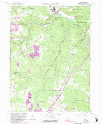
1963 Map of Polk
USGS Topo · Published 1991About this map
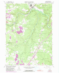
Sandy Creek winds through this rural Venango County landscape, defining a terrain shaped by the energy industry and conservation efforts. The presence of numerous Oil Wells and a Gas Well across the townships of Mineral, Victory, and Clinton speaks to the region's long-standing petroleum heritage. Transport infrastructure is anchored by the Conrail line, which follows the creek valley through Raymilton and Polk. Large swaths of the territory are dedicated to State Game Lands No 39 and the Kittanning State Forest, creating a mosaic of woodland and industry. For the genealogist, the map preserves the location of rural spiritual and community centers like Mt Pleasant Ch, Hebron Ch, and the Old Sandy Cem, alongside smaller crossroads such as Henderson Station and Woods Corners.
Find a feature on this map
48 named features on this map. Tap any name to fly to it.
Don’t see what you’re looking for? This feature index may not catch every label — zoom into the map to look around manually.
Map Details
Editions of this 1963 Polk Map
5 editions found
Other maps of this area

1909 · Franklin
USGS Topo · 1:62,500

1910 · Hilliards
USGS Topo · 1:62,500

1911 · Franklin
USGS Topo · 1:62,500

1911 · Stoneboro
USGS Topo · 1:62,500

1912 · Hilliards
USGS Topo · 1:62,500

1913 · Stoneboro
USGS Topo · 1:62,500

1913 · Mercer
USGS Topo · 1:62,500

1939 · Mercer
USGS Topo · 1:62,500

1943 · Mercer
USGS Topo · 1:62,500

1943 · Stoneboro
USGS Topo · 1:62,500