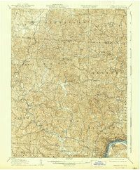
1907 Map of Pomeroy
USGS Topo · Published 1939About this map
The Ohio River curves sharply at the base of this landscape, anchoring the bustling river towns of Pomeroy and Middleport during an era of significant industrial transit. In the early 1900s, the Kanawha and Michigan RR followed the path of Leading Creek through Rutland and Salisbury, connecting these valley settlements to the broader regional economy. Further north, the terrain is defined by a dense network of post offices and small rural centers such as Shade PO, Downington PO, and Darwin PO, many of which served as the social hearts of their respective townships. Family names and local gathering points are preserved in landmarks like Bedford Church and Bunker Hill Church, providing a clear view of the communal geography before modern infrastructure consolidated these dispersed rural districts. The map also records the winding course of the Shade River and its various forks, including the Welsh Fork and Pratts Fork, which carved through the hills of Alexander and Lodi townships.
Find a feature on this map
64 named features on this map. Tap any name to fly to it.
Don’t see what you’re looking for? This feature index may not catch every label — zoom into the map to look around manually.
Map Details
Editions of this 1907 Pomeroy Map
3 editions found
Other maps of this area

1903 · Athens
USGS Topo · 1:62,500

1904 · Zaleski
USGS Topo · 1:62,500

1904 · Chesterhill
USGS Topo · 1:62,500

1905 · Athens
USGS Topo · 1:62,500

1905 · Wilkesville
USGS Topo · 1:62,500

1906 · Chesterhill
USGS Topo · 1:62,500

1906 · Bidwell
USGS Topo · 1:62,500

1907 · Pomeroy
USGS Topo · 1:62,500

1907 · Keno
USGS Topo · 1:62,500

1907 · Zaleski
USGS Topo · 1:62,500