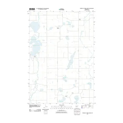
2010 Map of Pomme De Terre Lakes
USGS Topo · Published 2010About this map
The Pomme de Terre River and Chippewa River define the hydraulic landscape of Stevens County, carving through a glaciated terrain densely pocketed with prairie lakes. At the center of this 2010 survey, the Pomme de Terre Lakes are regulated by the Perkins Lake Dam, illustrating the managed water systems of modern Minnesota. The settlement pattern remains oriented toward the sectional grid, where small rural landmarks serve as the primary points of community history. Scattered across the landscape are several denominational burial grounds, including the Emmanuel Lutheran Cemetery and Kirkegaarden Cemetery, which anchor the area's genealogical record. From the northern reaches of Erickson Lake to the southern shores of Hanson Lake, the map documents a transition from agricultural fields to protected riparian corridors.
Find a feature on this map
27 named features on this map. Tap any name to fly to it.
Don’t see what you’re looking for? This feature index may not catch every label — zoom into the map to look around manually.
Map Details
Editions of this 2010 Pomme De Terre Lakes Map
This is the sole edition of this map. No revisions or reprints were ever made.
Other maps of this area

1911 · Barrett
USGS Topo · 1:62,500

1912 · Morris
USGS Topo · 1:62,500

1953 · Saint Cloud
USGS Topo · 1:250,000

1957 · Saint Cloud
USGS Topo · 1:250,000

1958 · Saint Cloud
USGS Topo · 1:250,000

1966 · Kensington
USGS Topo · 1:24,000

1968 · Cyrus
USGS Topo · 1:24,000

1968 · Starbuck NW
USGS Topo · 1:24,000
1973 · Patchen Lake
USGS Topo · 1:24,000
1973 · Morris
USGS Topo · 1:24,000