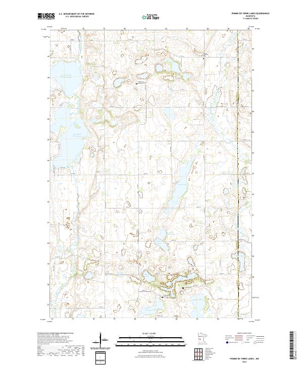
2022 Map of Pomme De Terre Lakes
USGS Topo · Published 2022About this map
Pomme de Terre River and the Chippewa River define this glaciated reach of Stevens and Pope Counties, where a dense network of prairie lakes dominates the hydrology. This landscape is characterized by its high concentration of small water bodies and wetlands, ranging from the expansive Pomme de Terre Lakes and Swan Lake to smaller basins like North Baker Lake and Bjork Lake. These features were central to the early organization of the rural community, as seen in the distribution of traditional burial grounds. Genealogists and local historians can find the locations of several established churchyards, including Emmanuel Lutheran Cem, Aeneas Lutheran Cem, Scandia Cem, and Kirkegaarden Cem. The map provides a precise look at the township grid and county line, showing how section-line roads like Co Rd 70 and Co Hwy 32 navigate the complex aquatic terrain of the region.
Find a feature on this map
39 named features on this map. Tap any name to fly to it.
Don’t see what you’re looking for? This feature index may not catch every label — zoom into the map to look around manually.
Map Details
Editions of this 2022 Pomme De Terre Lakes Map
This is the sole edition of this map. No revisions or reprints were ever made.
Other maps of this area

1911 · Barrett
USGS Topo · 1:62,500

1912 · Morris
USGS Topo · 1:62,500

1953 · Saint Cloud
USGS Topo · 1:250,000

1957 · Saint Cloud
USGS Topo · 1:250,000

1958 · Saint Cloud
USGS Topo · 1:250,000

1966 · Kensington
USGS Topo · 1:24,000

1968 · Cyrus
USGS Topo · 1:24,000

1968 · Starbuck NW
USGS Topo · 1:24,000
1973 · Patchen Lake
USGS Topo · 1:24,000
1973 · Morris
USGS Topo · 1:24,000