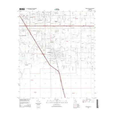
2015 Map of Ponchatoula
USGS Topo · Published 2015About this map
Ponchatoula and the southern edge of Hammond anchor this 2015 survey, illustrating the modern footprint of these historic Tangipahoa Parish communities. The corridor is defined by the heavy infrastructure of the Illinois Central RR and major highway networks that cut through the low-lying terrain. While suburban developments like Southwood Ridge, Villa West, and Happy Woods show recent growth, the map remains deeply rooted in its local geography. Named water bodies such as Ponchatoula Creek, Selsers Creek, and the Yellow Water River wind through the landscape, alongside man-made features like the Anderson Canal. For those researching local heritage, several burial grounds are documented, including Wetmore Cem near the Wadesboro area and Arnold Cem to the northeast. Small-scale settlements like Campbell and Oliver provide additional points of reference for tracing the evolution of these crossroads towns.
Find a feature on this map
106 named features on this map. Tap any name to fly to it.
Don’t see what you’re looking for? This feature index may not catch every label — zoom into the map to look around manually.
Map Details
Editions of this 2015 Ponchatoula Map
This is the sole edition of this map. No revisions or reprints were ever made.
Other maps of this area

1934 · Springfield
USGS Topo · 1:62,500

1935 · Ponchatoula
USGS Topo · 1:62,500

1939 · Ponchatoula
USGS Topo · 1:62,500

1939 · Springfield
USGS Topo · 1:62,500

1940 · Tickfaw
USGS Topo · 1:31,680

1942 · Robert
USGS Topo · 1:31,680

1949 · Albany
USGS Topo · 1:31,680

1951 · Ponchatoula
USGS Topo · 1:62,500

1954 · Baton Rouge
USGS Topo · 1:250,000

1956 · Baton Rouge
USGS Topo · 1:250,000