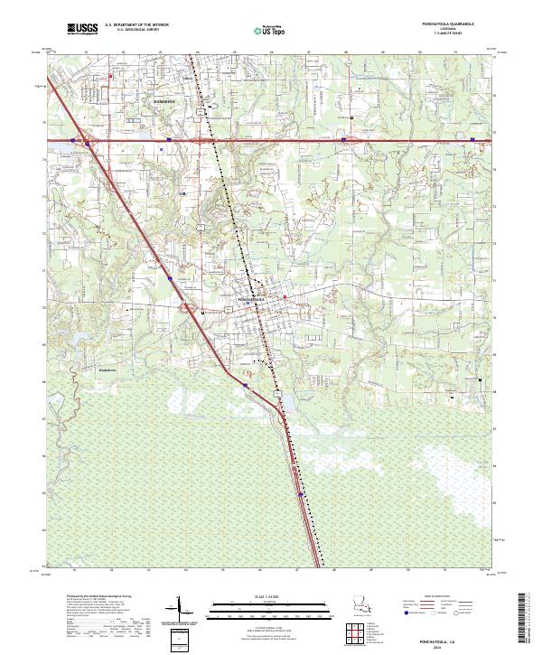
2024 Map of Ponchatoula
USGS Topo · Published 2024About this map
Ponchatoula and the southern edge of Hammond anchor this modern survey of Tangipahoa Parish, where the Piney Woods transition into the Louisiana wetlands. The landscape is defined by the legacy of the Illinois Central railroad corridor, visible today in the alignment of S Railroad Ave and SW Railroad Ave. To the west, the settlement of Wadesboro sits near the winding course of Ponchatoula Creek, while the southern reaches of the quadrangle dissolve into the Four Mile Marsh. Local history is preserved in several burial grounds, including the Ponchatoula Cem and Charbonnet Cem, which remain as quiet landmarks amid the growing suburban infrastructure and interstate frontage roads like I-55 Svc Rd. The presence of the Anderson Canal reflects the long-standing efforts to manage the water levels of this low-lying region.
Find a feature on this map
32 named features on this map. Tap any name to fly to it.
Don’t see what you’re looking for? This feature index may not catch every label — zoom into the map to look around manually.
Map Details
Editions of this 2024 Ponchatoula Map
This is the sole edition of this map. No revisions or reprints were ever made.
Other maps of this area

1934 · Springfield
USGS Topo · 1:62,500

1935 · Ponchatoula
USGS Topo · 1:62,500

1939 · Ponchatoula
USGS Topo · 1:62,500

1939 · Springfield
USGS Topo · 1:62,500

1940 · Tickfaw
USGS Topo · 1:31,680

1942 · Robert
USGS Topo · 1:31,680

1949 · Albany
USGS Topo · 1:31,680

1951 · Ponchatoula
USGS Topo · 1:62,500

1954 · Baton Rouge
USGS Topo · 1:250,000

1956 · Baton Rouge
USGS Topo · 1:250,000