
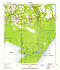
1951 Map of Ponchatoula
USGS Topo · Published 1968About this map
The Illinois Central railroad corridor serves as the primary artery through this Louisiana landscape, connecting the established hubs of Hammond and Ponchatoula to the north with the low-lying reaches of Jones Island. The transition from upland settlement to the wetlands surrounding Lake Maurepas and Lake Pontchartrain is marked by a complex network of waterways, including the Tickfaw River and Tangipahoa River. Evidence of early 20th-century industry is found in the extensive Lumber RR spurs that once penetrated the cypress and tupelo swamps.
Find a feature on this map
49 named features on this map. Tap any name to fly to it.
Don’t see what you’re looking for? This feature index may not catch every label — zoom into the map to look around manually.
Map Details
Editions of this 1951 Ponchatoula Map
3 editions found

Other maps of this area

1891 · Spanish Fort
USGS Topo · 1:62,500

1892 · Mount Airy
USGS Topo · 1:62,500

1892 · Bonnet Carre
USGS Topo · 1:62,500

1934 · Springfield
USGS Topo · 1:62,500

1935 · Covington
USGS Topo · 1:62,500

1935 · Ponchatoula
USGS Topo · 1:62,500

1936 · Ruddock
USGS Topo · 1:31,680

1936 · Bonnet Carre
USGS Topo · 1:62,500

1936 · Spanish Fort
USGS Topo · 1:62,500

1939 · Ponchatoula
USGS Topo · 1:62,500