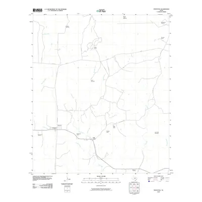
2010 Map of Pontotoc
USGS Topo · Published 2010About this map
Pontotoc and the neighboring community of Field Creek anchor this rural landscape in Llano County, showing a pattern of settlement defined by family ranches and essential water resources. The importance of education and local heritage is evident through the inclusion of the Hutchinson School and several burial grounds, including both the Old Pontotoc Cemetery and New Pontotoc Cemetery. The terrain is characterized by prominent landmarks like Lone Oak Mountain and Panther Rock, while the cattle-ranching economy is marked by numerous named water stations such as Jenkins Windmill and the Mining House Windmill. A network of seasonal waterways including Cold Creek and Panther Creek dictates the placement of rural roads like Hickory Grove Rd and Ranch Rd 501, illustrating how the geography of the Texas Hill Country shaped local transit and homesteading through the early 21st century.
Find a feature on this map
40 named features on this map. Tap any name to fly to it.
Don’t see what you’re looking for? This feature index may not catch every label — zoom into the map to look around manually.
Map Details
Editions of this 2010 Pontotoc Map
This is the sole edition of this map. No revisions or reprints were ever made.
Other maps of this area

1885 · San Saba
USGS Topo · 1:125,000

1887 · Llano
USGS Topo · 1:125,000

1887 · Mason
USGS Topo · 1:125,000

1894 · Brady
USGS Topo · 1:125,000

1894 · Mason
USGS Topo · 1:125,000

1894 · San Saba
USGS Topo · 1:125,000

1894 · Llano
USGS Topo · 1:125,000

1904 · Llano
USGS Topo · 1:125,000

1909 · Llano
USGS Topo · 1:125,000

1918 · Llano
USGS Topo · 1:125,000