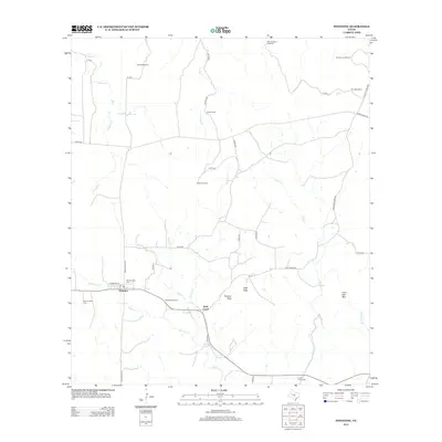
2012 Map of Pontotoc
USGS Topo · Published 2012About this map
Pontotoc and Field Creek anchor this Llano County landscape, where the ranching heritage of Central Texas is written in the names of family lands and livestock infrastructure. The cattle-working history of the region is evident through the mapping of the Nine-Bar Ranch, Taylor Ranch, and several remote landmarks like the Jenkins Windmill and East Murray Windmill. These features indicate a dependence on groundwater in a terrain defined by seasonal waterways such as Pontotoc Cr and Cold Cr. For those tracing local heritage, the map identifies significant communal sites including the Hutchinson School and several burial grounds. The distinction between the Old Pontotoc Cem and the New Pontotoc Cem provides a clear spatial record of the community's growth and continuity over generations, while prominent geological markers like Panther Rock and Lone Oak Mtn remain as permanent boundary points in the brush country.
Find a feature on this map
40 named features on this map. Tap any name to fly to it.
Don’t see what you’re looking for? This feature index may not catch every label — zoom into the map to look around manually.
Map Details
Editions of this 2012 Pontotoc Map
This is the sole edition of this map. No revisions or reprints were ever made.
Other maps of this area

1885 · San Saba
USGS Topo · 1:125,000

1887 · Llano
USGS Topo · 1:125,000

1887 · Mason
USGS Topo · 1:125,000

1894 · Brady
USGS Topo · 1:125,000

1894 · Mason
USGS Topo · 1:125,000

1894 · San Saba
USGS Topo · 1:125,000

1894 · Llano
USGS Topo · 1:125,000

1904 · Llano
USGS Topo · 1:125,000

1909 · Llano
USGS Topo · 1:125,000

1918 · Llano
USGS Topo · 1:125,000