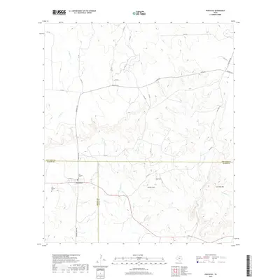
2019 Map of Pontotoc
USGS Topo · Published 2019About this map
Pontotoc sits at the intersection of three counties, where Mason, San Saba, and Llano meet in the heart of Texas Hill Country. This late-stage topographical survey reveals a landscape defined by significant elevation changes and seasonal drainage, anchored by the community of Pontotoc and its surrounding burial grounds. Genealogists can trace local lineage through the Old Pontotoc Cem, New Pontotoc Cem, and Cold Creek Cem, while land-use patterns show the winding paths of Ranch Rd 501 and W FM 501 as they navigate the rocky terrain. Distinctive landmarks like High Rock, Panther Rock, and Lone Oak Mtn rise above the network of creeks, including Field Cr and Panther Cr, which carve through the limestone-rich soil to form the area's characteristic topography.
Find a feature on this map
37 named features on this map. Tap any name to fly to it.
Don’t see what you’re looking for? This feature index may not catch every label — zoom into the map to look around manually.
Map Details
Editions of this 2019 Pontotoc Map
This is the sole edition of this map. No revisions or reprints were ever made.
Other maps of this area

1885 · San Saba
USGS Topo · 1:125,000

1887 · Llano
USGS Topo · 1:125,000

1887 · Mason
USGS Topo · 1:125,000

1894 · Brady
USGS Topo · 1:125,000

1894 · Mason
USGS Topo · 1:125,000

1894 · San Saba
USGS Topo · 1:125,000

1894 · Llano
USGS Topo · 1:125,000

1904 · Llano
USGS Topo · 1:125,000

1909 · Llano
USGS Topo · 1:125,000

1918 · Llano
USGS Topo · 1:125,000