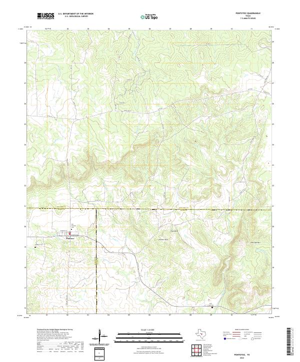
2022 Map of Pontotoc
USGS Topo · Published 2022About this map
Pontotoc sits at a historic crossroads in the Texas Hill Country, where the borders of San Saba, Mason, and Llano counties converge. This landscape is defined by its intermittent watercourses and prominent granite and sandstone formations, including Panther Rock, High Rock, and the elevation of Lone Oak Mountain to the east. The settlement pattern here reflects deep local roots, centered on Commerce Street and supported by several burial grounds including the Old Pontotoc Cemetery and the more modern Pontotoc Cemetery. Drainage follows a complex network of creeks such as Field Creek, Panther Creek, and Cold Creek, which carve through the undulating terrain. A dense network of ranch and county roads, including Ranch Road 501 and FM 501, connects the outlying acreage to the central village, tracing the same paths used by generations of Texas ranchers.
Find a feature on this map
37 named features on this map. Tap any name to fly to it.
Don’t see what you’re looking for? This feature index may not catch every label — zoom into the map to look around manually.
Map Details
Editions of this 2022 Pontotoc Map
This is the sole edition of this map. No revisions or reprints were ever made.
Other maps of this area

1885 · San Saba
USGS Topo · 1:125,000

1887 · Llano
USGS Topo · 1:125,000

1887 · Mason
USGS Topo · 1:125,000

1894 · Brady
USGS Topo · 1:125,000

1894 · Mason
USGS Topo · 1:125,000

1894 · San Saba
USGS Topo · 1:125,000

1894 · Llano
USGS Topo · 1:125,000

1904 · Llano
USGS Topo · 1:125,000

1909 · Llano
USGS Topo · 1:125,000

1918 · Llano
USGS Topo · 1:125,000