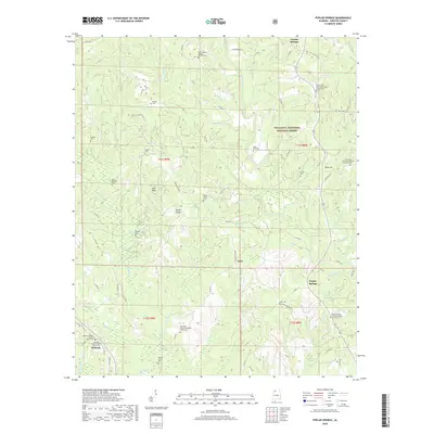
2018 Map of Poplar Springs
USGS Topo · Published 2018About this map
William B. Bankhead National Forest covers the northeastern portion of this Winston County landscape, where the terrain is defined by a dense network of creek drainages including Clear Creek and Wildcat Branch. Small communities and agricultural pockets like Poplar Springs, Natis, and Ashbank are connected by a web of county roads that navigate the complex topography. The map reveals a high concentration of rural religious and funerary sites, such as the Old Union Missionary Baptist Church Cemetery and Pine Tucky Missionary Baptist Church Cemetery, which serve as vital markers of local family history. Notable geological features like Bald Rock and the Wildcat Swamp highlight the varied environment between the forested uplands and the Blackwater Creek basin in the south.
Find a feature on this map
86 named features on this map. Tap any name to fly to it.
Don’t see what you’re looking for? This feature index may not catch every label — zoom into the map to look around manually.
Map Details
Editions of this 2018 Poplar Springs Map
This is the sole edition of this map. No revisions or reprints were ever made.
Other maps of this area

1893 · Jasper
USGS Topo · 1:125,000

1936 · Delmar
USGS Topo · 1:24,000

1949 · Manchester
USGS Topo · 1:24,000

1949 · Nauvoo
USGS Topo · 1:24,000

1950 · Nauvoo
USGS Topo · 1:24,000

1950 · Manchester
USGS Topo · 1:24,000

1953 · Birmingham
USGS Topo · 1:250,000

1956 · Birmingham
USGS Topo · 1:250,000

1956 · Gadsden
USGS Topo · 1:250,000

1957 · Birmingham
USGS Topo · 1:250,000