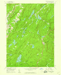
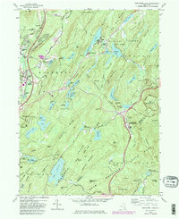
1957 Map of Popolopen Lake
USGS Topo · Published 1959About this map
The West Point Military Academy grounds and the surrounding highlands dominate this 1957 survey, revealing a landscape defined by tactical terrain and public recreation. The map captures the intersection of early transportation and modern infrastructure, where the Erie RR and the Albany Post Road parallel the newer thruway near Highland Mills and Central Valley. Historic footprints like the Quaker Meetinghouse and Cemetery of the Highlands sit alongside the academic and scientific presence of the Columbia Univ Arden House and Perkins Memorial Observatory.
Find a feature on this map
107 named features on this map. Tap any name to fly to it.
Don’t see what you’re looking for? This feature index may not catch every label — zoom into the map to look around manually.
Map Details
Editions of this 1957 Popolopen Lake Map
5 editions found
Other maps of this area

1891 · Ramapo
USGS Topo · 1:62,500

1892 · West Point
USGS Topo · 1:62,500

1892 · Tarrytown
USGS Topo · 1:62,500

1893 · Tarrytown
USGS Topo · 1:62,500

1893 · Ramapo
USGS Topo · 1:62,500

1894 · West Point
USGS Topo · 1:62,500

1899 · West Point
USGS Topo · 1:62,500

1901 · West Point
USGS Topo · 1:62,500

1902 · Tarrytown
USGS Topo · 1:62,500

1902 · Schunemunk
USGS Topo · 1:62,500