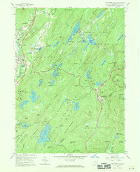
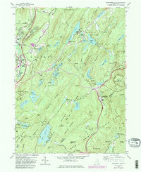
1957 Map of Popolopen Lake
USGS Topo · Published 1970About this map
Popolopen Lake and the rugged highlands of Orange and Rockland counties dominate this mid-century landscape, characterized by dense mountain terrain and a complex network of recreational and military activity. The U.S. Military Academy West Point reservation occupies the northeastern quadrant, featuring Camp Buckner and Mine Lake. To the west, the valley corridor through Central Valley and Highland Mills shows the impact of transportation infrastructure, with the Erie RR and the Thruway providing critical north-south access. Cultural landmarks such as the Quaker Meetinghouse and the Cemetery of the Highlands point to the area's deep-rooted Quaker and local heritage. In the south, the expansion of the Palisades Interstate Parkway and the Appalachian Trail underscores the region's transition into a major outdoor recreation hub, punctuated by sites like the Anthony Wayne Recreation Area and the Perkins Memorial Observatory atop Bear Mountain.
Find a feature on this map
113 named features on this map. Tap any name to fly to it.
Don’t see what you’re looking for? This feature index may not catch every label — zoom into the map to look around manually.
Map Details
Editions of this 1957 Popolopen Lake Map
5 editions found
Other maps of this area

1891 · Ramapo
USGS Topo · 1:62,500

1892 · West Point
USGS Topo · 1:62,500

1892 · Tarrytown
USGS Topo · 1:62,500

1893 · Tarrytown
USGS Topo · 1:62,500

1893 · Ramapo
USGS Topo · 1:62,500

1894 · West Point
USGS Topo · 1:62,500

1899 · West Point
USGS Topo · 1:62,500

1901 · West Point
USGS Topo · 1:62,500

1902 · Tarrytown
USGS Topo · 1:62,500

1902 · Schunemunk
USGS Topo · 1:62,500