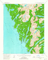
1951 Map of Port Alexander B-3 and B-4
USGS Topo · Published 1963About this map
Baranof Island presents a complex coastline of deep fjords and glacial lakes in this mid-century survey. The terrain is dominated by steep peaks such as Rudakof Mountain and Ptarmigan Peak, which overlook a network of narrow waterways including Big Branch Bay and Snipe Bay. Small maritime settlements and research outposts are positioned at protected harbors, most notably Big Port Walter on the eastern shore and Port Armstrong further south. These locations were historically significant for fisheries and biological research within the Tongass National Forest.
Find a feature on this map
50 named features on this map. Tap any name to fly to it.
Don’t see what you’re looking for? This feature index may not catch every label — zoom into the map to look around manually.
Map Details
Editions of this 1951 Port Alexander B-3 and B-4 Map
Other maps of this area

1948 · Port Alexander A-2
USGS Topo · 1:63,360
1948 · Port Alexander A-3
USGS Topo · 1:63,360

1948 · Port Alexander B-2
USGS Topo · 1:63,360

1951 · Port Alexander C-4
USGS Topo · 1:63,360

1951 · Port Alexander C-2
USGS Topo · 1:63,360

1951 · Port Alexander B-3 and B-4
USGS Topo · 1:63,360

1951 · Port Alexander C-3
USGS Topo · 1:63,360

1951 · Port Alexander
USGS Topo · 1:250,000

1951 · Port Alexander B-2
USGS Topo · 1:63,360
1951 · Port Alexander A-3
USGS Topo · 1:63,360