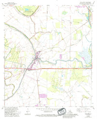
1968 Map of Port Barre
USGS Topo · Published 1994About this map
Port Barre stands at a critical hydrological junction in St. Landry Parish, where the waters of Bayou Courtableu and Bayou Teche meet amidst a complex network of wetlands and agricultural tracts. This landscape is defined by the tension between natural watercourses like Bayou Waukesha and industrial infrastructure, including the Port Barre Oil and Gas Field and several prominent pipelines. The presence of the Missouri Pacific RR underscores the town's historical role as a transit point, while the vast Thistlethwaite State Wildlife Management Area to the north preserves a portion of the native ecosystem. Genealogists and local historians can trace small settlements such as Hazelwood and Poplar Grove, along with family-named landmarks like DeVillier Cem and Saquette Cem, which dot the ridges and bayou banks.
Find a feature on this map
46 named features on this map. Tap any name to fly to it.
Don’t see what you’re looking for? This feature index may not catch every label — zoom into the map to look around manually.
Map Details
Editions of this 1968 Port Barre Map
2 editions found
Other maps of this area

1939 · Opelousas
USGS Topo · 1:62,500

1940 · Arnaudville
USGS Topo · 1:62,500

1952 · Lake Charles
USGS Topo · 1:250,000

1954 · Lake Charles
USGS Topo · 1:250,000

1954 · Baton Rouge
USGS Topo · 1:250,000

1956 · Opelousas
USGS Topo · 1:62,500

1956 · Baton Rouge
USGS Topo · 1:250,000

1957 · Opelousas
USGS Topo · 1:62,500

1957 · Carencro
USGS Topo · 1:62,500

1959 · Palmetto
USGS Topo · 1:62,500