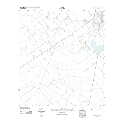
2010 Map of Port Lavaca West
USGS Topo · Published 2010About this map
Clark Family Cemetery serves as a quiet genealogical anchor west of the growing coastal hub of Port Lavaca. Located north of Chocolate Bayou, this site reflects the deep-rooted family ties that define the rural reaches of Calhoun County. The landscape is a network of drainage and farm-to-market routes, including the transition from the settlement at Clark Station toward the marshes of Chocolate Bay. Small aviation infrastructure, such as Tanners Airport, punctuates the open spaces between Little Chocolate Bayou and the southern reaches of East Coloma Creek. The map documents a coastal prairie undergoing subtle changes in land use, where established rural roads like Boemerville Rd and Jester Rd connect isolated homesteads to the primary thoroughfares leading into the city.
Find a feature on this map
36 named features on this map. Tap any name to fly to it.
Don’t see what you’re looking for? This feature index may not catch every label — zoom into the map to look around manually.
Map Details
Editions of this 2010 Port Lavaca West Map
This is the sole edition of this map. No revisions or reprints were ever made.
Other maps of this area

1952 · Port Lavaca East
USGS Topo · 1:24,000

1952 · Point Comfort
USGS Topo · 1:24,000

1952 · Kamey
USGS Topo · 1:24,000

1952 · Seadrift NE
USGS Topo · 1:24,000

1952 · Austwell
USGS Topo · 1:24,000

1952 · Seadrift
USGS Topo · 1:24,000

1952 · Port Lavaca West
USGS Topo · 1:24,000

1952 · Placedo
USGS Topo · 1:24,000

1952 · Green Lake
USGS Topo · 1:24,000

1953 · Beeville
USGS Topo · 1:250,000