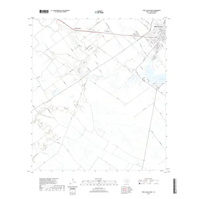
2019 Map of Port Lavaca West
USGS Topo · Published 2019About this map
Chocolate Bayou winds through the coastal lowlands of Calhoun County, carving a path toward the expansive Chocolate Bay in this recent survey. The landscape is a mosaic of agricultural tracts and bayou-side developments, reflecting the area's continued reliance on its water-bound geography. Port Lavaca occupies the northeastern corner of the map, showing a dense street grid that includes the Port Lavaca Cem and proximity to Tanner's Airport.
Find a feature on this map
88 named features on this map. Tap any name to fly to it.
Don’t see what you’re looking for? This feature index may not catch every label — zoom into the map to look around manually.
Map Details
Editions of this 2019 Port Lavaca West Map
This is the sole edition of this map. No revisions or reprints were ever made.
Other maps of this area

1952 · Port Lavaca East
USGS Topo · 1:24,000

1952 · Point Comfort
USGS Topo · 1:24,000

1952 · Kamey
USGS Topo · 1:24,000

1952 · Seadrift NE
USGS Topo · 1:24,000

1952 · Austwell
USGS Topo · 1:24,000

1952 · Seadrift
USGS Topo · 1:24,000

1952 · Port Lavaca West
USGS Topo · 1:24,000

1952 · Placedo
USGS Topo · 1:24,000

1952 · Green Lake
USGS Topo · 1:24,000

1953 · Beeville
USGS Topo · 1:250,000