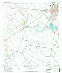
1995 Map of Port Lavaca West
USGS Topo · Published 1995About this map
The coastal expansion of Port Lavaca is clearly visible in this mid-1990s landscape, where the traditional residential grid meets an evolving industrial and recreational perimeter. The town's institutional backbone is well-documented through facilities like Memorial Hospital, Snowcrab Stadium, and the County Fairgrounds. To the west, the land transitions into an intensive petroleum and irrigation network. Numerous Oil Wells, Gas Wells, and a maze of Levee systems define the drainage patterns around Chocolate Bayou and Monkey Slough.
Find a feature on this map
54 named features on this map. Tap any name to fly to it.
Don’t see what you’re looking for? This feature index may not catch every label — zoom into the map to look around manually.
Map Details
Editions of this 1995 Port Lavaca West Map
This is the sole edition of this map. No revisions or reprints were ever made.
Other maps of this area

1952 · Port Lavaca East
USGS Topo · 1:24,000

1952 · Point Comfort
USGS Topo · 1:24,000

1952 · Kamey
USGS Topo · 1:24,000

1952 · Seadrift NE
USGS Topo · 1:24,000

1952 · Austwell
USGS Topo · 1:24,000

1952 · Seadrift
USGS Topo · 1:24,000

1952 · Port Lavaca West
USGS Topo · 1:24,000

1952 · Placedo
USGS Topo · 1:24,000

1952 · Green Lake
USGS Topo · 1:24,000

1953 · Beeville
USGS Topo · 1:250,000