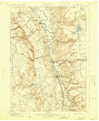
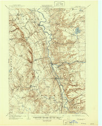
1907 Map of Port Leyden
USGS Topo · Published 1925About this map
Black River forms the central spine of this landscape at the dawn of the twentieth century, acting as the industrial and transportation corridor for the communities of Port Leyden and Lyons Falls. The arrival of the New York Central and Hudson River RR and the Glenfield and Western RR facilitated the movement of timber and goods from the Adirondack foothills. Industrial activity is evident at Goulds Mill and along the various creeks that feed into the main river valley, such as Mill Creek and Roaring Brook. To the west, the terrain rises toward the Tug Hill plateau, marked by deep incisions like Whetstone Gulf. Small agrarian and milling settlements like Constableville, Houseville, and Locust Grove dot the landscape, while the area around Brantingham Lake shows the early patterns of seasonal and local habitation in the eastern uplands of Lewis County.
Find a feature on this map
71 named features on this map. Tap any name to fly to it.
Don’t see what you’re looking for? This feature index may not catch every label — zoom into the map to look around manually.
Map Details
Editions of this 1907 Port Leyden Map
6 editions found
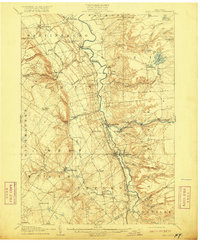
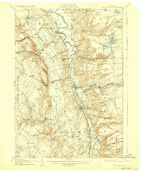
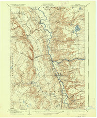
Other maps of this area

1897 · Remsen
USGS Topo · 1:62,500

1900 · Remsen
USGS Topo · 1:62,500

1902 · Carthage
USGS Topo · 1:62,500

1904 · Boonville
USGS Topo · 1:62,500

1904 · Carthage
USGS Topo · 1:62,500

1905 · Port Leyden
USGS Topo · 1:62,500

1905 · Taberg
USGS Topo · 1:62,500

1906 · Highmarket
USGS Topo · 1:62,500

1907 · Port Leyden
USGS Topo · 1:62,500

1911 · Lowville
USGS Topo · 1:62,500