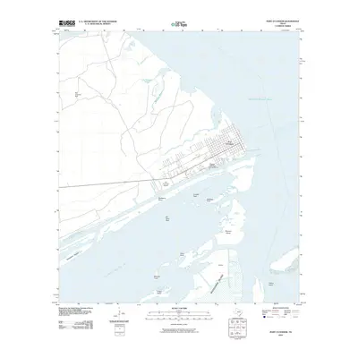
2010 Map of Port O'Connor
USGS Topo · Published 2010About this map
Port O'Connor serves as the focal point of this coastal landscape, situated where the mainland meets the vast waters of Matagorda Bay and Espiritu Santo Bay. The 2010 map details a complex maritime environment shaped by bayous and barrier islands, including the northern reach of Matagorda Island and the isolated Pelican Island. Navigational landmarks like Mailboat Point and Teller Point emphasize the area's historical reliance on water travel and local fishing.
Find a feature on this map
28 named features on this map. Tap any name to fly to it.
Don’t see what you’re looking for? This feature index may not catch every label — zoom into the map to look around manually.
Map Details
Editions of this 2010 Port O'Connor Map
This is the sole edition of this map. No revisions or reprints were ever made.
Other maps of this area

1951 · Keller Bay
USGS Topo · 1:24,000

1952 · Port Lavaca East
USGS Topo · 1:24,000

1952 · Pass Cavallo SW
USGS Topo · 1:24,000

1952 · Long Island
USGS Topo · 1:24,000

1952 · Seadrift NE
USGS Topo · 1:24,000

1952 · Decros Point
USGS Topo · 1:24,000

1952 · Port O'Connor
USGS Topo · 1:24,000

1953 · Beeville
USGS Topo · 1:250,000

1956 · Beeville
USGS Topo · 1:250,000

1960 · Beeville
USGS Topo · 1:250,000