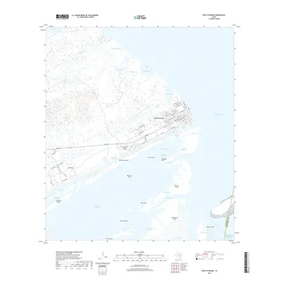
2019 Map of Port O'Connor
USGS Topo · Published 2019About this map
Port O'Connor serves as a critical coastal hub where the Intracoastal Waterway meets the expansive waters of Matagorda Bay and Espiritu Santo Bay. This 2019 survey captures the town's grid of residential streets, including Main St and Adams Ave, situated just north of the Port O'Connor Private Airport. The landscape is defined by its complex maritime geography, featuring numerous tidal bayous such as LaSalle Bayou and Huckleberry Bayou that thread through the northern wetlands. To the south, the barrier environment is marked by significant landmarks like Matagorda Island and Pelican Island near Pass Cavallo. Local hazards and navigational points are clearly identified, from Everett Reef and Bill Days Reef to narrow passages like Mitchells Cut and Fishermans Cut. This map illustrates a modern coastal community deeply integrated with its surrounding estuary and protected island systems.
Find a feature on this map
77 named features on this map. Tap any name to fly to it.
Don’t see what you’re looking for? This feature index may not catch every label — zoom into the map to look around manually.
Map Details
Editions of this 2019 Port O'Connor Map
This is the sole edition of this map. No revisions or reprints were ever made.
Other maps of this area

1951 · Keller Bay
USGS Topo · 1:24,000

1952 · Port Lavaca East
USGS Topo · 1:24,000

1952 · Pass Cavallo SW
USGS Topo · 1:24,000

1952 · Long Island
USGS Topo · 1:24,000

1952 · Seadrift NE
USGS Topo · 1:24,000

1952 · Decros Point
USGS Topo · 1:24,000

1952 · Port O'Connor
USGS Topo · 1:24,000

1953 · Beeville
USGS Topo · 1:250,000

1956 · Beeville
USGS Topo · 1:250,000

1960 · Beeville
USGS Topo · 1:250,000