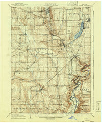
1905 Map of Portage
USGS Topo · Published 1941About this map
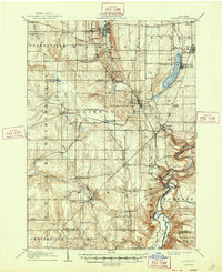
Genesee River gorges and the dramatic drop of the Upper Falls, Middle Falls, and Lower Falls dominate the eastern edge of this Wyoming County landscape. This early twentieth-century survey reveals a region defined by its rail-and-water geography, where the Erie RR and the Buffalo Rochester and Pittsburg RR converge near Silver Lake Junction. The northern shores of Silver Lake are particularly developed, showing the Silver Lake Assembly and the village of Perry. Away from the river, the map documents a dense network of upland settlements like Wethersfield Springs, Orangeville Center, and Rock Glen, reflecting a mature agricultural and early industrial economy before the consolidation of rural communities. The intricate contouring around Warsaw illustrates the steep valley walls that shaped the growth of these western New York towns.
Find a feature on this map
78 named features on this map. Tap any name to fly to it.
Don’t see what you’re looking for? This feature index may not catch every label — zoom into the map to look around manually.
Map Details
Editions of this 1905 Portage Map
6 editions found
Other maps of this area

1904 · Batavia
USGS Topo · 1:62,500

1904 · Caledonia
USGS Topo · 1:62,500

1905 · Attica
USGS Topo · 1:62,500

1905 · Portage
USGS Topo · 1:62,500

1905 · Nunda
USGS Topo · 1:62,500

1906 · Angelica
USGS Topo · 1:62,500

1916 · Canaseraga
USGS Topo · 1:62,500

1923 · Arcade
USGS Topo · 1:62,500

1924 · Franklinville
USGS Topo · 1:62,500

1925 · Arcade
USGS Topo · 1:62,500