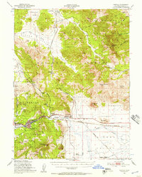
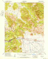
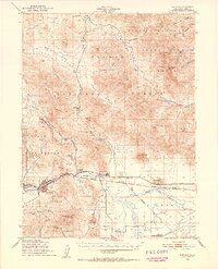
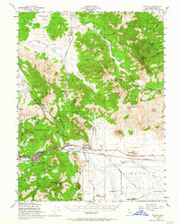
1950 Map of Portola
USGS Topo · Published 1957About this map
The Middle Fork Feather River carves through this Plumas County landscape, serving as a corridor for both the Western Pacific Railroad and the primary settlements of Portola and Delleker. The map captures the region's mid-century transition from a heavy logging focus to a more diversified mountain economy, evidenced by the presence of the Plumas County Airport alongside vestiges of older industries. Evidence of timber extraction is everywhere, specifically in the traces of the Dixie Logging Railroad and another unnamed Logging Railroad.
Find a feature on this map
80 named features on this map. Tap any name to fly to it.
Don’t see what you’re looking for? This feature index may not catch every label — zoom into the map to look around manually.
Map Details
Editions of this 1950 Portola Map
4 editions found
Other maps of this area

1886 · Honey Lake
USGS Topo · 1:250,000

1890 · Sierraville
USGS Topo · 1:125,000

1891 · Downieville
USGS Topo · 1:125,000

1891 · Honey Lake
USGS Topo · 1:250,000

1892 · Sierraville
USGS Topo · 1:125,000

1893 · Honey Lake
USGS Topo · 1:250,000

1893 · Downieville
USGS Topo · 1:125,000

1894 · Sierraville
USGS Topo · 1:125,000

1895 · Downieville
USGS Topo · 1:125,000

1896 · Downieville
USGS Topo · 1:125,000