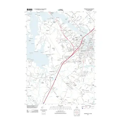
2012 Map of Portsmouth
USGS Topo · Published 2012About this map
The Piscataqua River shoreline and the complex coastal topography of the Great Bay define this regional study. This area serves as a primary maritime and industrial gateway, evidenced by the concentration of infrastructure around Portsmouth, including the Portsmouth Pier and multiple crossings like the General Sullivan Bridge and Memorial Bridge. The transition from urban density in Christian Shore and Atlantic Heights to the residential character of Pannaway Manor and Greenland is clearly marked. Local history is anchored by significant preservation sites such as the Governor John Langdon House and Garden and numerous resting places like Calvary Cem and Saint Marys Cem. The map also captures the sprawling footprint of the Portsmouth International Airport at Pease, illustrating the shift from naval reliance to multifaceted modern transport.
Find a feature on this map
265 named features on this map. Tap any name to fly to it.
Don’t see what you’re looking for? This feature index may not catch every label — zoom into the map to look around manually.
Map Details
Editions of this 2012 Portsmouth Map
This is the sole edition of this map. No revisions or reprints were ever made.
Other maps of this area

1888 · Newburyport
USGS Topo · 1:62,500

1890 · Newburyport
USGS Topo · 1:62,500

1893 · Dover
USGS Topo · 1:62,500

1893 · York
USGS Topo · 1:62,500

1894 · Newburyport
USGS Topo · 1:62,500

1916 · Dover
USGS Topo · 1:62,500

1918 · Dover
USGS Topo · 1:62,500

1920 · York
USGS Topo · 1:62,500

1932 · Newburyport
USGS Topo · 1:48,000

1934 · Exeter
USGS Topo · 1:62,500