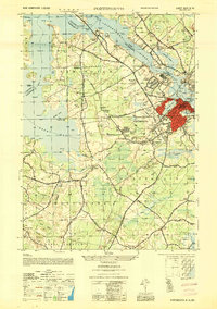
1952 Map of Portsmouth
USGS Topo · Published 1952About this map
The Piscataqua River serves as the focal point for this mid-century survey, dividing New Hampshire from Maine and shaping the industrial and residential growth of Portsmouth. The city's core is densely developed, radiating from Christian Shore and Freemans Point toward newer residential pockets like Pannaway Manor and Wentworth Acres. The maritime and transit importance of the harbor is evident in the presence of the Memorial Bridge and the General Sullivan Bridge, alongside the busy Portsmouth Municipal Airport to the west.
Find a feature on this map
106 named features on this map. Tap any name to fly to it.
Don’t see what you’re looking for? This feature index may not catch every label — zoom into the map to look around manually.
Map Details
Editions of this 1952 Portsmouth Map
This is the sole edition of this map. No revisions or reprints were ever made.
Other maps of this area

1888 · Newburyport
USGS Topo · 1:62,500

1890 · Newburyport
USGS Topo · 1:62,500

1893 · Dover
USGS Topo · 1:62,500

1893 · York
USGS Topo · 1:62,500

1894 · Newburyport
USGS Topo · 1:62,500

1916 · Dover
USGS Topo · 1:62,500

1918 · Dover
USGS Topo · 1:62,500

1920 · York
USGS Topo · 1:62,500

1932 · Newburyport
USGS Topo · 1:48,000

1934 · Exeter
USGS Topo · 1:62,500