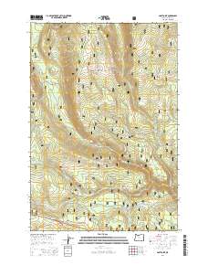
2014 Map of Post Point
USGS Topo · Published 2014About this map
The Mount Hood National Forest landscape in Wasco County is defined by a dense network of watercourses and early mountain thoroughfares. The White River flows through the southern portion of the quadrangle, joined by numerous tributaries including Boulder Cr, Cedar Cr, and Frog Cr. Historical transportation is a central theme, with the trace of the Old Barlow Rd and Barlow Rd cutting across the terrain, recalling the overland emigrant routes of the nineteenth century. These primitive roads are contrasted by more modern developments like the Warm Springs Hwy and Wapinitia Hwy. Higher elevations are marked by prominent lookouts such as Post Point, Dobry Point, and Boulder Point. The northern reaches feature Little Boulder Lake and a series of springs, including Bell Spring, Faith Spring, and Charity Spring, which historically supported livestock and travelers in this high-altitude drainage basin.
Find a feature on this map
50 named features on this map. Tap any name to fly to it.
Don’t see what you’re looking for? This feature index may not catch every label — zoom into the map to look around manually.
Map Details
Editions of this 2014 Post Point Map
This is the sole edition of this map. No revisions or reprints were ever made.
Other maps of this area

1924 · Mount Hood
USGS Topo · 1:125,000

1927 · Mount Hood
USGS Topo · 1:125,000

1930 · Dufur
USGS Topo · 1:125,000

1934 · Dufur
USGS Topo · 1:125,000

1953 · The Dalles
USGS Topo · 1:250,000

1956 · The Dalles
USGS Topo · 1:250,000

1956 · Mt. Wilson
USGS Topo · 1:62,500

1957 · The Dalles
USGS Topo · 1:250,000

1962 · Rock Creek Reservoir
USGS Topo · 1:24,000
1962 · Foreman Point
USGS Topo · 1:24,000