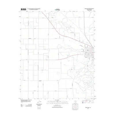
2012 Map of Post West
USGS Topo · Published 2012About this map
The town of Post serves as the primary hub on this High Plains landscape, where the residential grid gives way to the open ranch and oil country of Garza County. To the west, the settlement of Close City and the locality of Graham sit within a structured network of section roads like Farm-To-Market Road 399. The terrain is defined by the drainage of Sand Cr and Cooper Cr, while the Huntley Oil Field in the north indicates the region's long-standing reliance on petroleum extraction. Modern development is visible through landmarks such as Camp Post and Golf Course Rd, juxtaposed against historical transport routes like Old Lubbock Rd. This survey documents a transitional environment where the Caprock escarpment influences the flow of seasonal creeks toward the Brazos River watershed.
Find a feature on this map
36 named features on this map. Tap any name to fly to it.
Don’t see what you’re looking for? This feature index may not catch every label — zoom into the map to look around manually.
Map Details
Editions of this 2012 Post West Map
This is the sole edition of this map. No revisions or reprints were ever made.
Other maps of this area

1954 · Lubbock
USGS Topo · 1:250,000

1965 · Southland
USGS Topo · 1:24,000

1968 · South Dokegood Creek
USGS Topo · 1:24,000

1969 · Cap Rock SE
USGS Topo · 1:24,000

1969 · Post East
USGS Topo · 1:24,000

1969 · Grassland SE
USGS Topo · 1:24,000

1969 · Post West
USGS Topo · 1:24,000

1969 · Cooper Creek
USGS Topo · 1:24,000
1969 · Middle Creek
USGS Topo · 1:24,000

1970 · Grassland
USGS Topo · 1:24,000