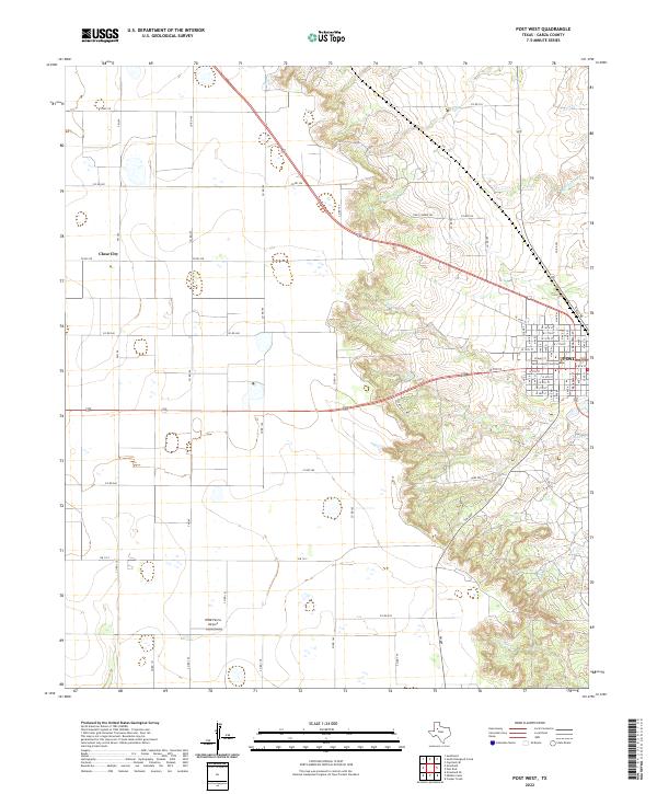
2022 Map of Post West
USGS Topo · Published 2022About this map
Post serves as the focal point of this West Texas landscape, where the town grid meets the dramatic breaks of the Caprock Escarpment. The Garza County Courthouse stands at the center of the community, surrounded by numbered streets like W 15th St and W 11th St. The terrain transitions sharply from the level plains of the Llano Estacado in the west, home to Close City and the WWD Farms Airport, into the eroded drainage basins of the east. These canyons are carved by intermittent watercourses including Falls Cr and Rattlesnake Cr. The road network, comprising a mix of Farm to Market roads like FM 669 and localized paths such as Camp Post, highlights the area's dual character of agricultural plateau and broken ranch land.
Find a feature on this map
68 named features on this map. Tap any name to fly to it.
Don’t see what you’re looking for? This feature index may not catch every label — zoom into the map to look around manually.
Map Details
Editions of this 2022 Post West Map
This is the sole edition of this map. No revisions or reprints were ever made.
Other maps of this area

1954 · Lubbock
USGS Topo · 1:250,000

1965 · Southland
USGS Topo · 1:24,000

1968 · South Dokegood Creek
USGS Topo · 1:24,000

1969 · Cap Rock SE
USGS Topo · 1:24,000

1969 · Post East
USGS Topo · 1:24,000

1969 · Grassland SE
USGS Topo · 1:24,000

1969 · Post West
USGS Topo · 1:24,000

1969 · Cooper Creek
USGS Topo · 1:24,000
1969 · Middle Creek
USGS Topo · 1:24,000

1970 · Grassland
USGS Topo · 1:24,000