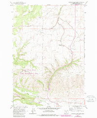
1962 Map of Postage Stamp Butte
USGS Topo · Published 1987About this map
Kingsley stands as a quiet focus of agricultural life on this high plateau, surrounded by the wheat lands and drainage systems of the eastern Cascades foothills. The landscape is defined by the massive divide of Tygh Ridge, rising to the Tygh Ridge Summit and dropping sharply into deep incisions like Butler Canyon. In the southern portion of the map, the terrain descends toward the Tygh Valley, where the Tygh Valley Fairgrounds and the Highline Ditch reflect the importance of communal gathering and irrigation in this arid environment. Conservation efforts are evident in the White River State Game Management Area, which encompasses the distinctive Postage Stamp Butte. A network of watercourses including Tygh Creek and Badger Creek carve through the basalt layers, while the Kingsley Cem remains a primary site for genealogical study in the region.
Find a feature on this map
25 named features on this map. Tap any name to fly to it.
Don’t see what you’re looking for? This feature index may not catch every label — zoom into the map to look around manually.
Map Details
Editions of this 1962 Postage Stamp Butte Map
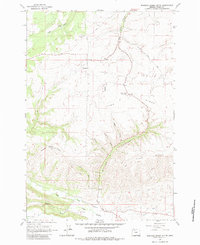
3 editions found
Other maps of this area

1930 · Dufur
USGS Topo · 1:125,000

1934 · Dufur
USGS Topo · 1:125,000

1953 · The Dalles
USGS Topo · 1:250,000

1956 · The Dalles
USGS Topo · 1:250,000

1957 · The Dalles
USGS Topo · 1:250,000

1962 · Sherars Bridge
USGS Topo · 1:24,000

1962 · Wolf Run
USGS Topo · 1:24,000

1962 · Postage Stamp Butte
USGS Topo · 1:24,000

1962 · Wamic
USGS Topo · 1:24,000

1962 · Dufur East
USGS Topo · 1:24,000