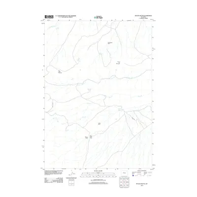
2012 Map of Potato Butte
USGS Topo · Published 2012About this map
Big Table Mountain and the prominent Potato Butte define this high-altitude landscape in Fremont County, where numerous natural water sources have sustained activity for generations. This 2012 survey details a terrain marked by strategic springs such as Big Table Mountain Spring, McQueen Spring, and Rainwater Spring, which serve as vital points of interest for those tracing the history of local land use.
Find a feature on this map
21 named features on this map. Tap any name to fly to it.
Don’t see what you’re looking for? This feature index may not catch every label — zoom into the map to look around manually.
Map Details
Editions of this 2012 Potato Butte Map
This is the sole edition of this map. No revisions or reprints were ever made.
Other maps of this area

1951 · Mexican Pass
USGS Topo · 1:24,000

1951 · Morrison Canyon
USGS Topo · 1:24,000

1951 · Jenkins Mountain
USGS Topo · 1:24,000

1952 · Kates Basin
USGS Topo · 1:24,000

1955 · Thermopolis
USGS Topo · 1:250,000
1957 · Jenkins Mountain
USGS Topo · 1:24,000

1958 · Thermopolis
USGS Topo · 1:250,000

1962 · Thermopolis
USGS Topo · 1:250,000

1965 · Arapahoe Ranch
USGS Topo · 1:24,000
1965 · Potato Butte
USGS Topo · 1:24,000