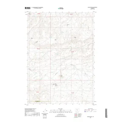
2017 Map of Potato Butte
USGS Topo · Published 2017About this map
Potato Butte rises above a complex network of ephemeral drainage and isolated water sources along the Hot Springs Co Fremont Co line. The landscape is defined by its vital springs, such as Rainwater Spring, Val Day Spring, and Potato Butte Spring, which traditionally served as essential stopovers in this arid environment. Significant topographical markers like Big Table Mtn and Round Top Mtn anchor the high ground, while Miners Gulch suggests the historical presence of extraction efforts in the vicinity. Settlement here is sparse, with transportation primarily limited to Red Canyon Rd and Canyon Rd, which navigate the draws and basins of this high-elevation territory. This map documents a remote section of central Wyoming where seasonal water and rugged landforms dictate the rhythm of human and wildlife activity.
Find a feature on this map
32 named features on this map. Tap any name to fly to it.
Don’t see what you’re looking for? This feature index may not catch every label — zoom into the map to look around manually.
Map Details
Editions of this 2017 Potato Butte Map
This is the sole edition of this map. No revisions or reprints were ever made.
Other maps of this area

1951 · Mexican Pass
USGS Topo · 1:24,000

1951 · Morrison Canyon
USGS Topo · 1:24,000

1951 · Jenkins Mountain
USGS Topo · 1:24,000

1952 · Kates Basin
USGS Topo · 1:24,000

1955 · Thermopolis
USGS Topo · 1:250,000
1957 · Jenkins Mountain
USGS Topo · 1:24,000

1958 · Thermopolis
USGS Topo · 1:250,000

1962 · Thermopolis
USGS Topo · 1:250,000

1965 · Arapahoe Ranch
USGS Topo · 1:24,000
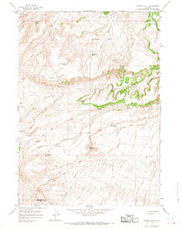
1965 · Potato Butte
USGS Topo · 1:24,000