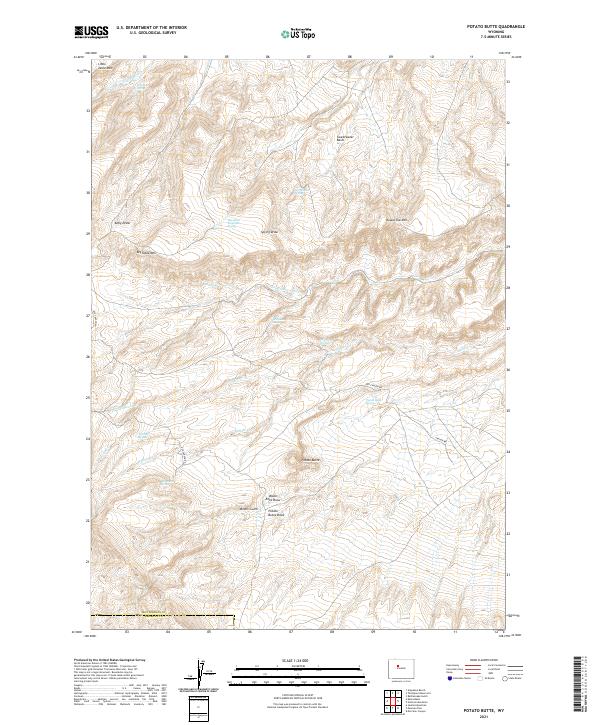
2021 Map of Potato Butte
USGS Topo · Published 2021About this map
The boundary between Hot Springs and Fremont Counties runs across the southern edge of this high-altitude landscape, where drainage patterns and naming conventions suggest a history of prospecting and ranching. The namesake Potato Butte stands as a central landmark, flanked by significant topographical features such as Big Table Mtn and Round Top Mtn. The presence of Miners Gulch and Black Rock Draw indicates the region's mineral interests, while a network of springs—including Sweetwater Spring, McQueen Spring, and Merrill Spring—supports life in this arid environment.
Find a feature on this map
32 named features on this map. Tap any name to fly to it.
Don’t see what you’re looking for? This feature index may not catch every label — zoom into the map to look around manually.
Map Details
Editions of this 2021 Potato Butte Map
This is the sole edition of this map. No revisions or reprints were ever made.
Other maps of this area

1951 · Mexican Pass
USGS Topo · 1:24,000

1951 · Morrison Canyon
USGS Topo · 1:24,000

1951 · Jenkins Mountain
USGS Topo · 1:24,000

1952 · Kates Basin
USGS Topo · 1:24,000

1955 · Thermopolis
USGS Topo · 1:250,000
1957 · Jenkins Mountain
USGS Topo · 1:24,000

1958 · Thermopolis
USGS Topo · 1:250,000

1962 · Thermopolis
USGS Topo · 1:250,000

1965 · Arapahoe Ranch
USGS Topo · 1:24,000
1965 · Potato Butte
USGS Topo · 1:24,000