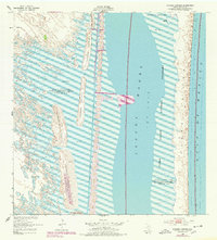
1952 Map of Potrero Cortado
USGS Topo · Published 1978About this map
Laguna Madre defines this coastal landscape, separating the mainland from the slender barrier of Padre Island. In the mid-20th century, the Intracoastal Waterway provided a vital navigational corridor through the shallow waters, flanked by numerous Spoil Banks resulting from dredging operations. The western shore is characterized by complex sand and mud flats where several distinct topographic rises known as potreros emerge, including Potrero Cortado and Potrero De Las Canelas. Isolated water sources like the Lopeno Artesian Well and Medanito Well indicate the reliance on deep water in this arid saline environment. The designation of the Padre Island National Seashore reflects the transition of this territory toward federal conservation, while features like Potrero Farias and Potrero Lopeno preserve names of local historical significance.
Find a feature on this map
19 named features on this map. Tap any name to fly to it.
Don’t see what you’re looking for? This feature index may not catch every label — zoom into the map to look around manually.
Map Details
Editions of this 1952 Potrero Cortado Map
3 editions found
Other maps of this area

1923 · Lopena Island
USGS Topo · 1:62,500

1923 · Saltillo Ranch
USGS Topo · 1:62,500

1928 · Sarita
USGS Topo · 1:125,000

1950 · Corpus Christi
USGS Topo · 1:250,000

1951 · Potrero Lopeno NW
USGS Topo · 1:24,000

1951 · Sarita 4 NE
USGS Topo · 1:24,000

1952 · Potrero Cortado
USGS Topo · 1:24,000

1952 · Yarborough Pass
USGS Topo · 1:24,000

1952 · Sarita 4 SE
USGS Topo · 1:24,000

1952 · Potrero Lopeno
USGS Topo · 1:62,500