Loading...
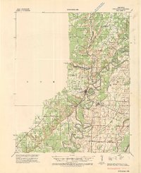
Loading map...1935 Map of Powhatan
USGS Topo · Published 1955About this map
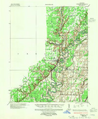
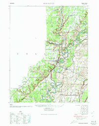
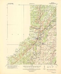
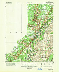
The confluence of the Black River and Spring River dominates this landscape, illustrating a river-based economy in the mid-1930s. The settlement of Powhatan serves as a focal point near the river bends, while Black Rock marks a key crossing for the St Louis San Francisco RR. This era of transport is further detailed by several active crossings, including Gibson Ferry, Scotts Ferry, and Cox Ferry, which provided essential links before the widespread construction of modern bridges.
Find a feature on this map
69 named features on this map. Tap any name to fly to it.
Don’t see what you’re looking for? This feature index may not catch every label — zoom into the map to look around manually.
Map Details
Date Portrayed1935
Date Published1955
PublisherU.S. Geological Survey
Map TypeTopographic
Scale1:62,500
Physical Dimensions17.9 x 21.8 inches
Editions of this 1935 Powhatan Map
4 editions found
Historical Maps of Hoxie Through Time
Featured Locations
Source Details
SourceU.S. Geological Survey
CopyrightPublic Domain