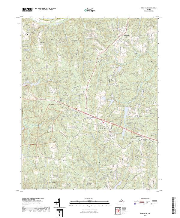
2022 Map of Powhatan
USGS Topo · Published 2022About this map
Powhatan serves as the focal point of this Virginia quadrangle, dominated by the historic Powhatan County Courthouse and its surrounding network of local roads. The landscape is defined by the branching tributaries of the James River basin, including Deep Creek, Fine Cr, and Fighting Cr, which cut through the Piedmont terrain. Small rural crossroads such as Macon, Provost, and Worshams anchor the surrounding countryside, reflecting long-standing settlement patterns in the county. Genealogists and local historians will find value in the location of Belmead Cem and Petersville Cem, as well as the proximity of several distinct water bodies like John L Lewis Lake and Randolph Lake. The inclusion of Plainview Airport and Saunders Field highlights the diverse land use in this central Virginia corridor.
Find a feature on this map
118 named features on this map. Tap any name to fly to it.
Don’t see what you’re looking for? This feature index may not catch every label — zoom into the map to look around manually.
Map Details
Editions of this 2022 Powhatan Map
This is the sole edition of this map. No revisions or reprints were ever made.
Other maps of this area

1890 · Goochland
USGS Topo · 1:125,000

1891 · Palmyra
USGS Topo · 1:125,000

1891 · Farmville
USGS Topo · 1:125,000

1892 · Goochland
USGS Topo · 1:125,000

1893 · Farmville
USGS Topo · 1:125,000

1895 · Palmyra
USGS Topo · 1:125,000

1897 · Amelia
USGS Topo · 1:125,000

1897 · Palmyra
USGS Topo · 1:125,000

1943 · Goochland
USGS Topo · 1:31,680

1943 · Fine Creek Mills
USGS Topo · 1:31,680