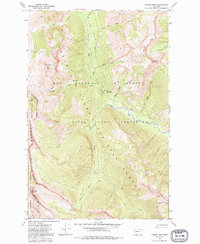
1970 Map of Prairie Reef
USGS Topo · Published 1992About this map
Bob Marshall Wilderness and the Sun River Game Preserve dominate this high-altitude landscape in the northern Rockies. The area, mapped in the late 1960s, serves as a crucial corridor for wildlife and watershed protection, defined by the towering Chinese Wall and the peak of Prairie Reef. A network of historic pack trails provides the only access through these protected lands, connecting remote landmarks such as the Prairie Reef Lookout and the Indian Point Guard Station.
Find a feature on this map
25 named features on this map. Tap any name to fly to it.
Don’t see what you’re looking for? This feature index may not catch every label — zoom into the map to look around manually.
Map Details
Editions of this 1970 Prairie Reef Map
3 editions found
Other maps of this area

1902 · Ovando
USGS Topo · 1:125,000

1903 · Saypo
USGS Topo · 1:125,000

1903 · Coopers Lake
USGS Topo · 1:125,000

1905 · Ovando
USGS Topo · 1:125,000

1936 · Silvertip
USGS Topo · 1:96,000

1942 · Silvertip
USGS Topo · 1:125,000

1955 · Choteau
USGS Topo · 1:250,000

1957 · Choteau
USGS Topo · 1:250,000

1958 · Choteau
USGS Topo · 1:250,000

1958 · Glenn Creek
USGS Topo · 1:24,000