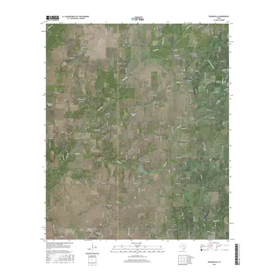
2016 Map of Prairieville
USGS Topo · Published 2016About this map
The Kaufman Co Van Zandt Co boundary line bisects this landscape, marking a rural territory where small Texas communities like Prairieville, Roddy, and Odom anchor a network of county roads. In the southwest corner, the growing edge of Mabank appears along the highway corridor, providing a contrast to the dispersed farmsteads and agricultural plots that dominate the rest of the quadrangle. Water distribution is defined by the winding paths of Lacy Fork, Caney Cr, and Prairie Cr, which feed into local catchments such as Richards Lake and Whitaker Pond. Genealogists will find several notable burial sites preserved here, including Beard Cem, Traver Cem, and Aanonsen Cem. The terrain is characterized by a series of low ridges and creek bottoms, with a dense web of numbered county roads and ranch-to-market routes like FM 90 and FM 47 connecting the various settlements and livestock operations.
Find a feature on this map
106 named features on this map. Tap any name to fly to it.
Don’t see what you’re looking for? This feature index may not catch every label — zoom into the map to look around manually.
Map Details
Editions of this 2016 Prairieville Map
This is the sole edition of this map. No revisions or reprints were ever made.
Other maps of this area

1920 · Kemp
USGS Topo · 1:62,500

1948 · Martins Mill
USGS Topo · 1:62,500

1949 · Martins Mill
USGS Topo · 1:62,500

1954 · Dallas
USGS Topo · 1:250,000

1956 · Tyler
USGS Topo · 1:250,000

1957 · Kemp
USGS Topo · 1:62,500

1958 · Dallas
USGS Topo · 1:250,000

1960 · Tool
USGS Topo · 1:24,000

1960 · Mabank
USGS Topo · 1:24,000

1961 · Kemp
USGS Topo · 1:24,000