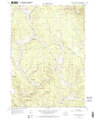
1956 Map of Preacher Spring
USGS Topo · Published 1974About this map
Black Hills National Forest land defines the character of this mid-century topographic study, which documents a landscape carved by complex drainage systems and isolated water sources. Published through cooperation with the United States Atomic Energy Commission, the map reveals a remote ranching and forest environment where life centered on named springs and remote outposts like the Howell Ranch. The terrain is marked by deep draws and canyons, including Redbird Canyon and Gillette Canyon, which channel the flow toward the South Fork Castle Creek in the north.
Find a feature on this map
27 named features on this map. Tap any name to fly to it.
Don’t see what you’re looking for? This feature index may not catch every label — zoom into the map to look around manually.
Map Details
Editions of this 1956 Preacher Spring Map
4 editions found
Other maps of this area

1894 · Deadwood
USGS Topo · 1:125,000

1896 · Harney Peak
USGS Topo · 1:125,000

1898 · Sundance
USGS Topo · 1:125,000

1899 · Newcastle
USGS Topo · 1:125,000

1901 · Harney Peak
USGS Topo · 1:125,000

1901 · Deadwood
USGS Topo · 1:125,000

1901 · Newcastle
USGS Topo · 1:125,000

1902 · Sundance
USGS Topo · 1:125,000

1916 · Deadwood
USGS Topo · 1:125,000

1951 · Fanny Peak
USGS Topo · 1:24,000