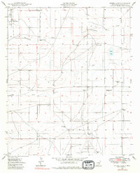
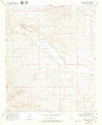
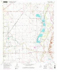
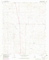
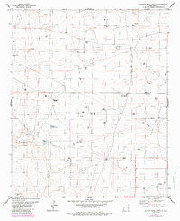
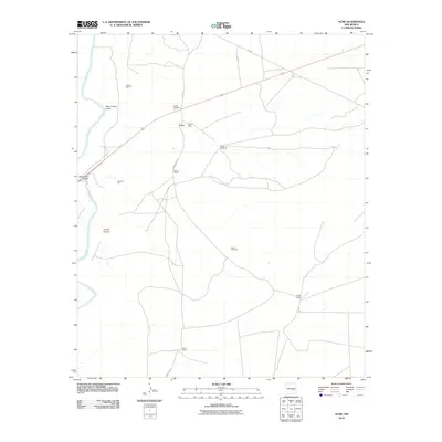
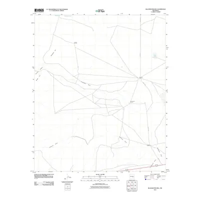
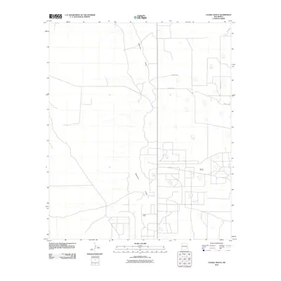
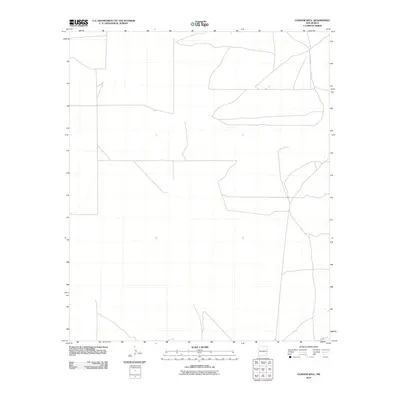
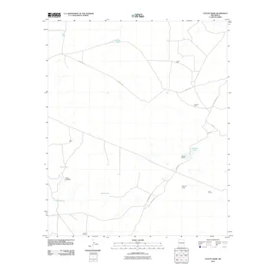
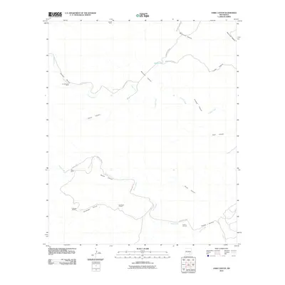
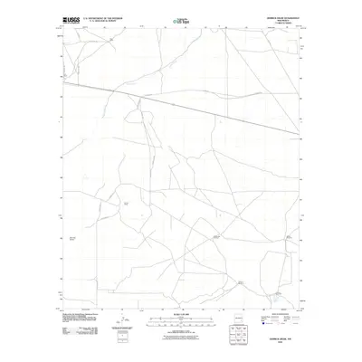
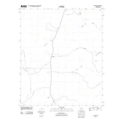
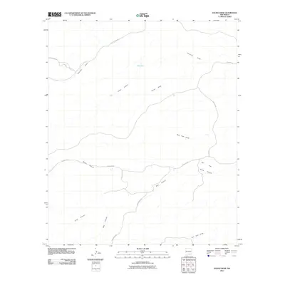
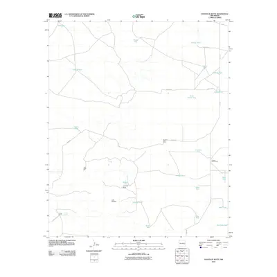
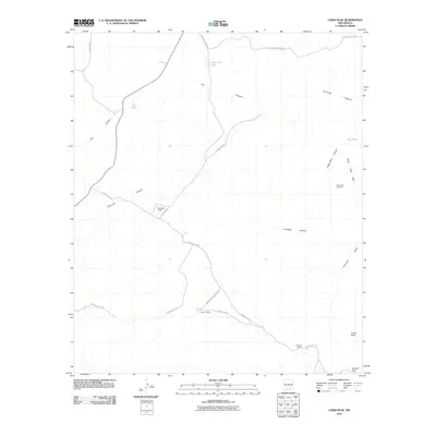
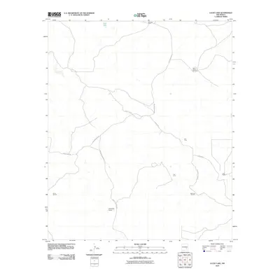
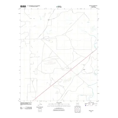
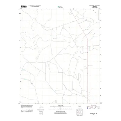
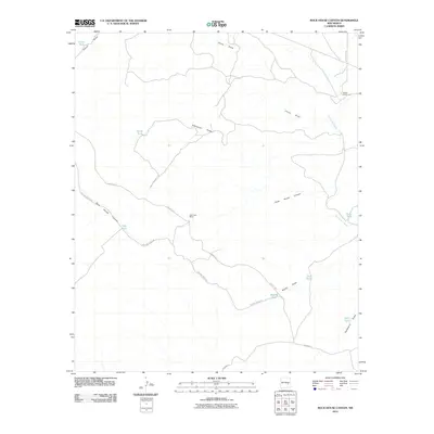
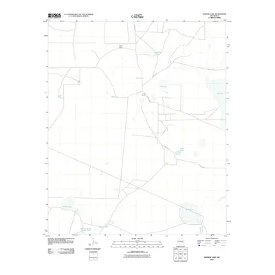
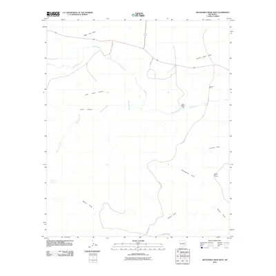
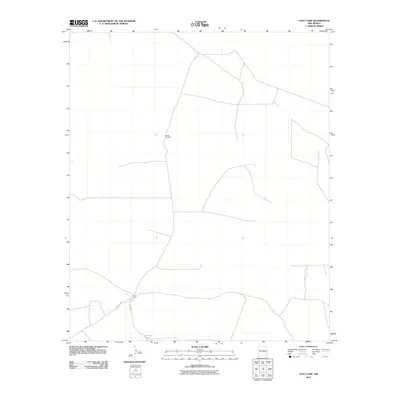
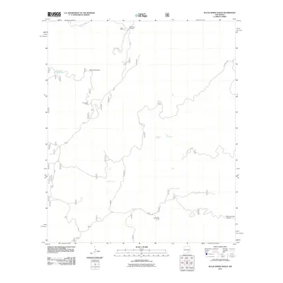
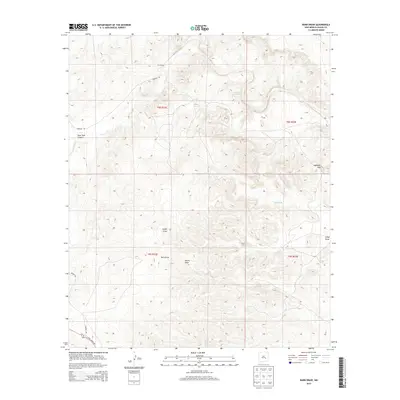
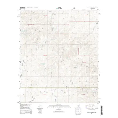
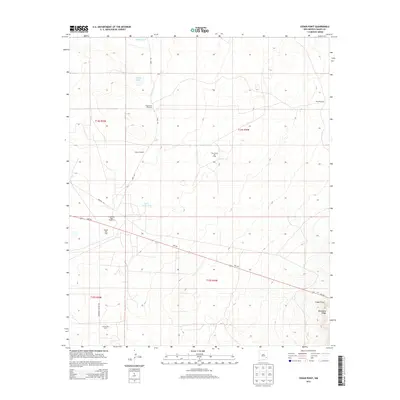
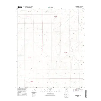
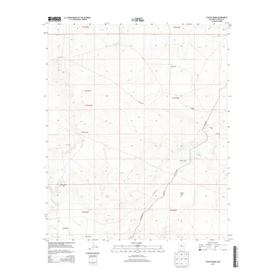
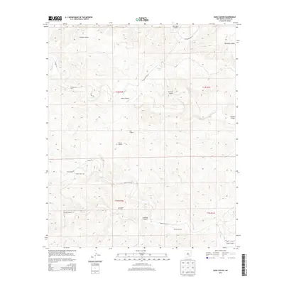
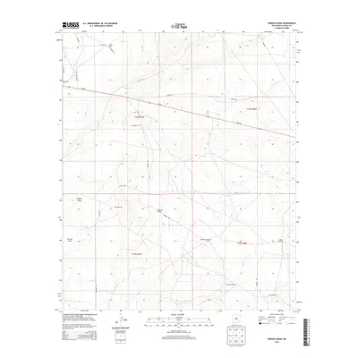
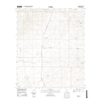
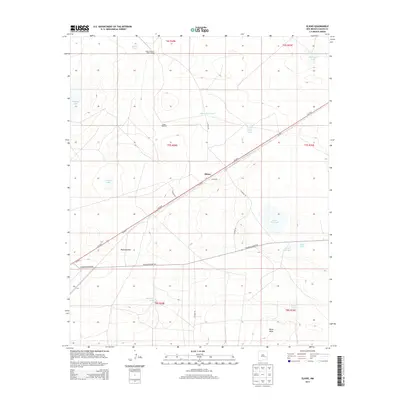
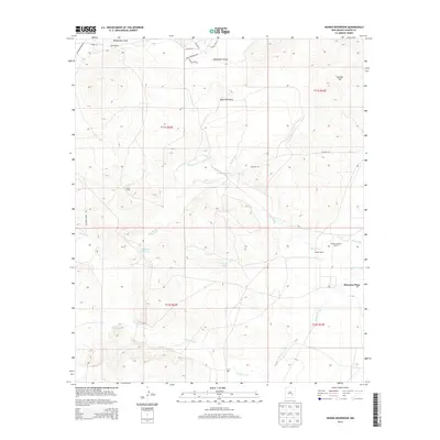
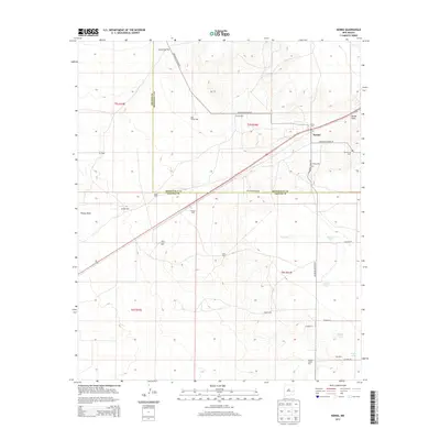
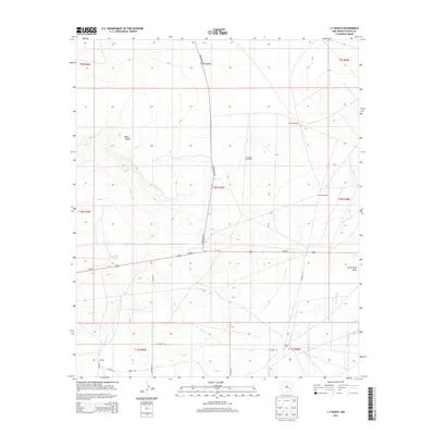
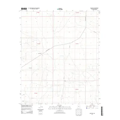
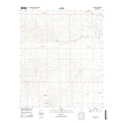
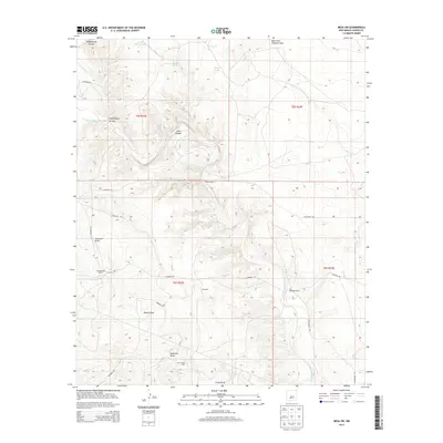
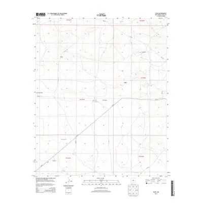
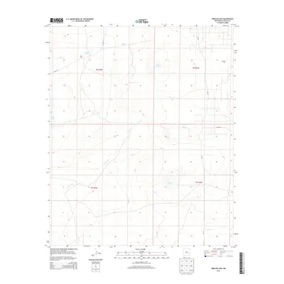
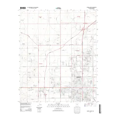
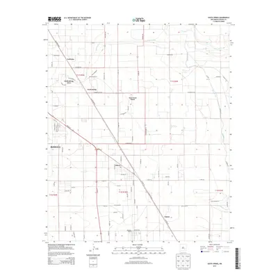
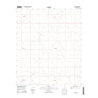
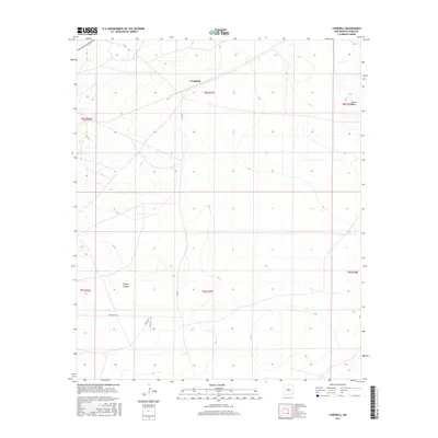
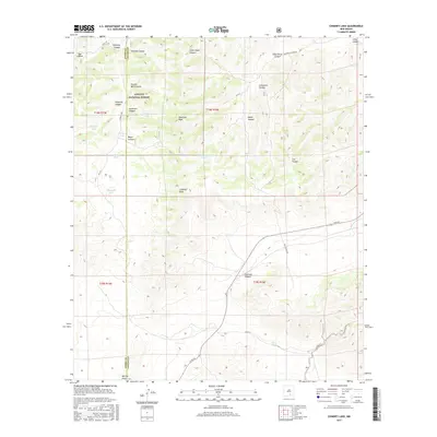
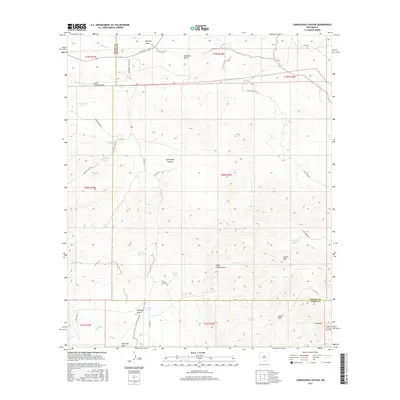
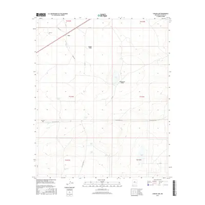
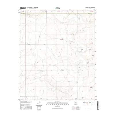
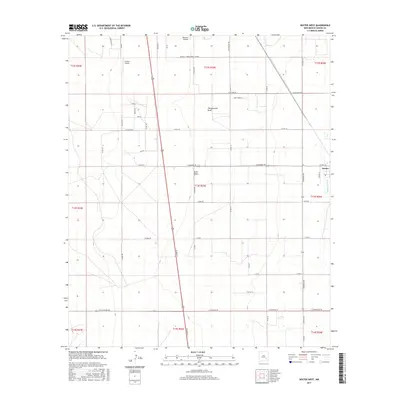
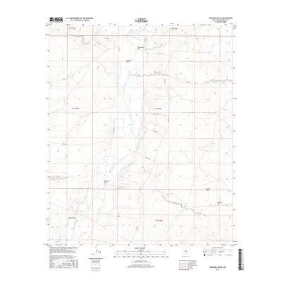
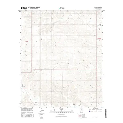
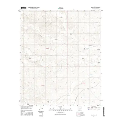
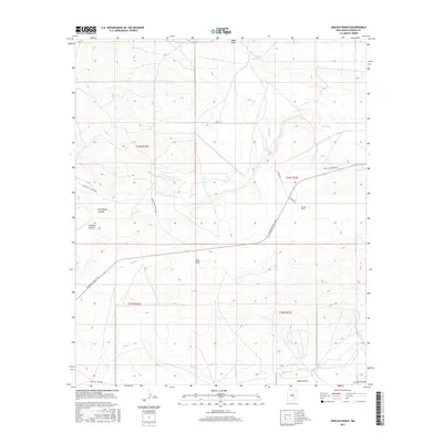
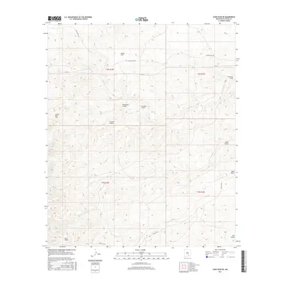
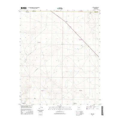
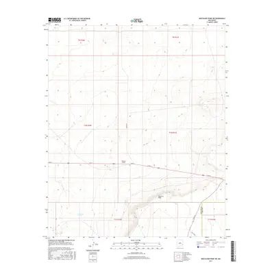
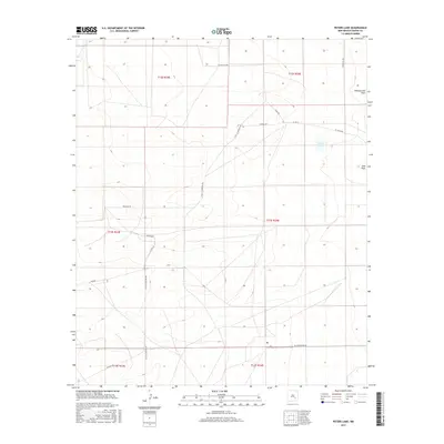
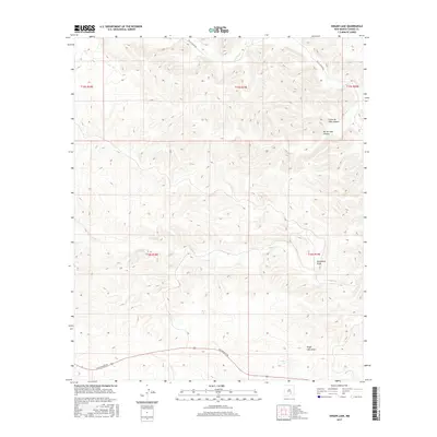
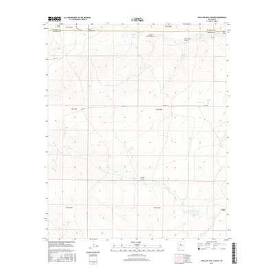
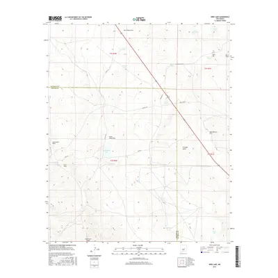
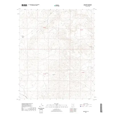
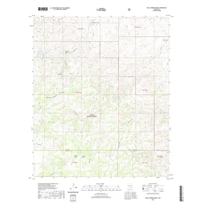
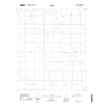
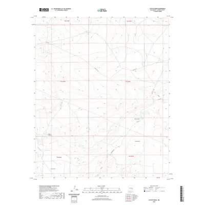
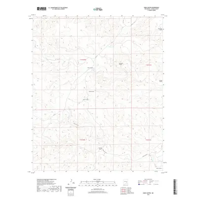
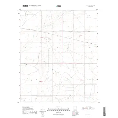
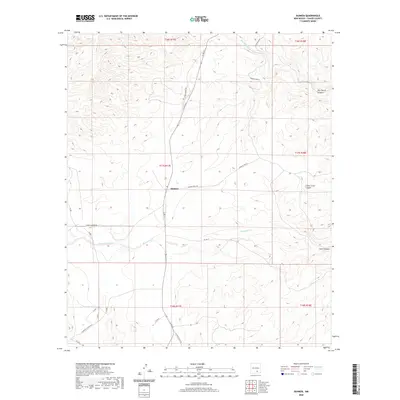
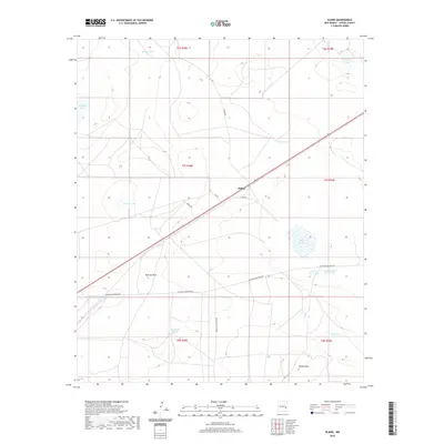
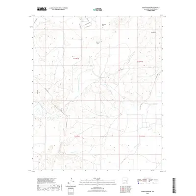
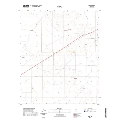
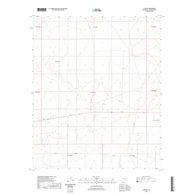
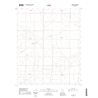
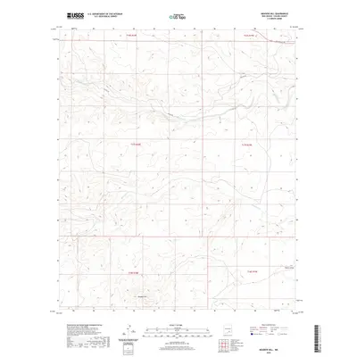
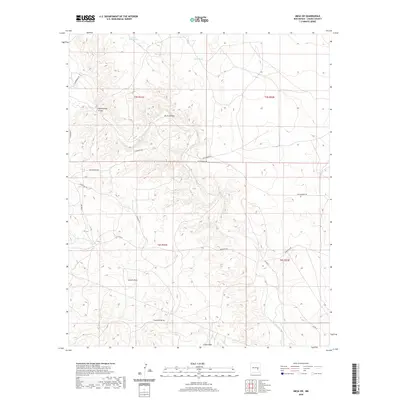
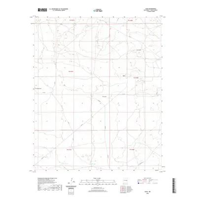
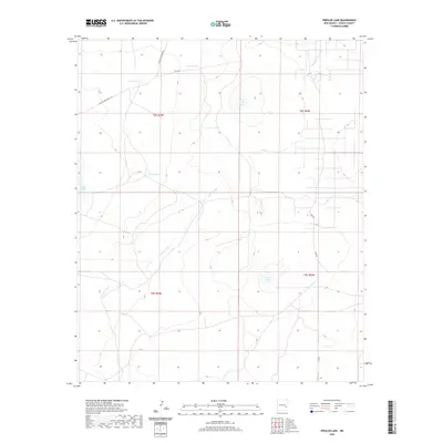
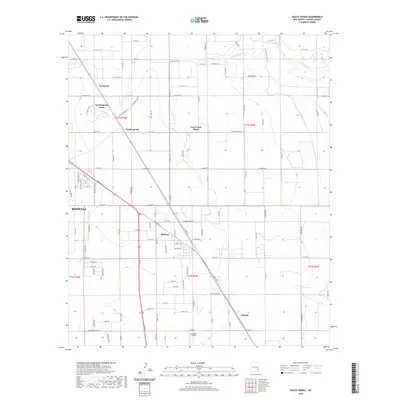
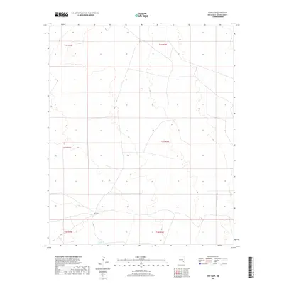
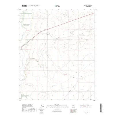
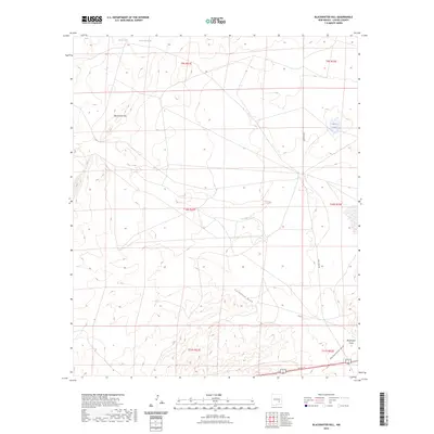
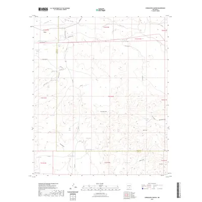
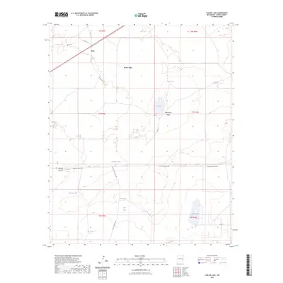
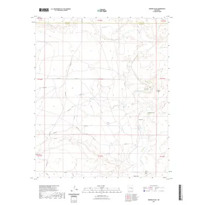
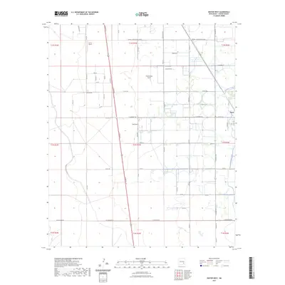
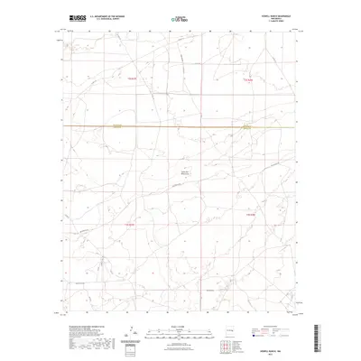
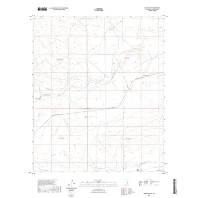
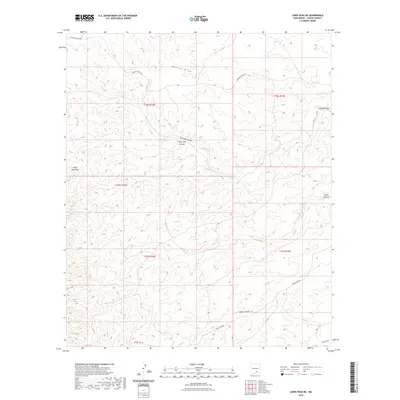
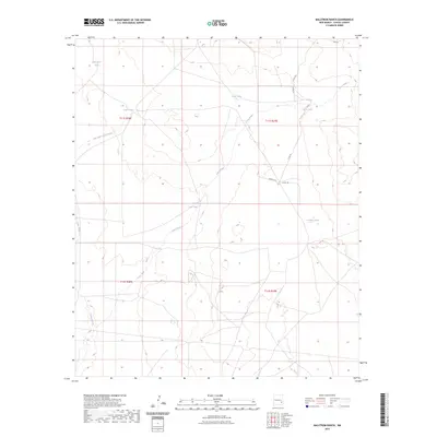
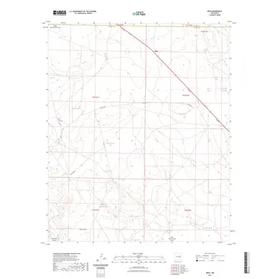
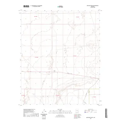
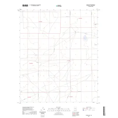
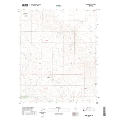
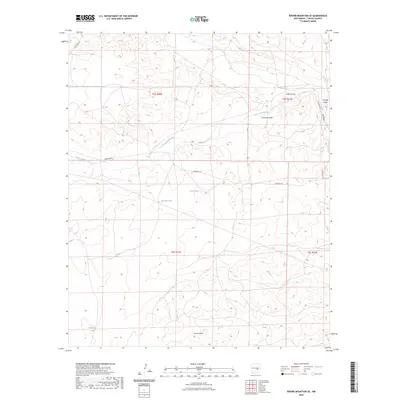
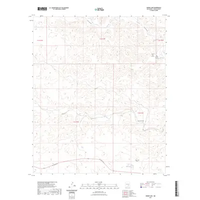
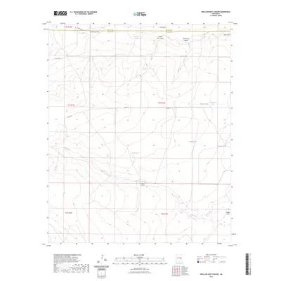
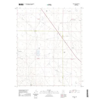
1978 Map of Presler Lake
USGS Topo · Published 1985About this map
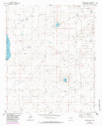
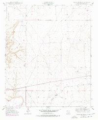
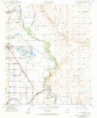
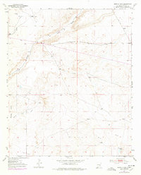
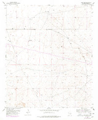
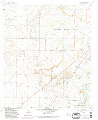
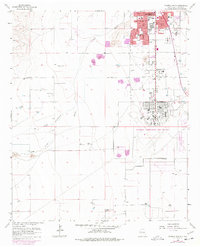
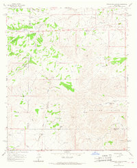
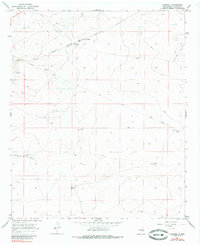
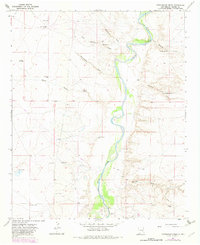
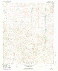
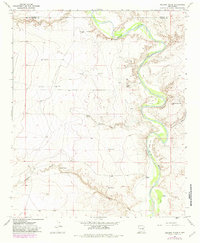
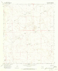
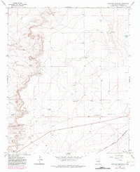
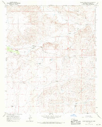
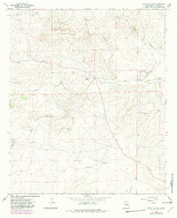
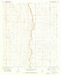
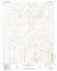
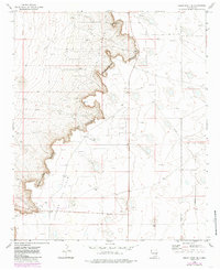
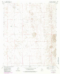
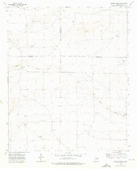
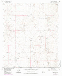
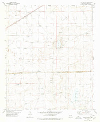
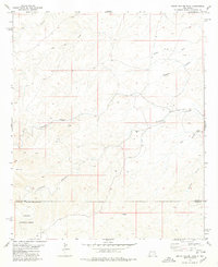
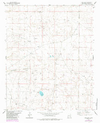
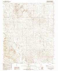
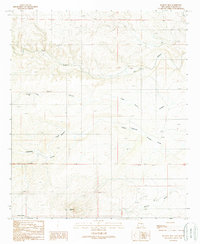
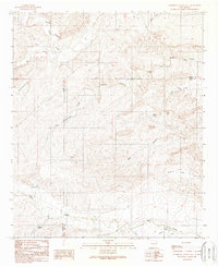
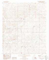
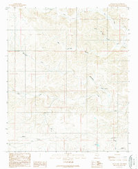
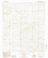
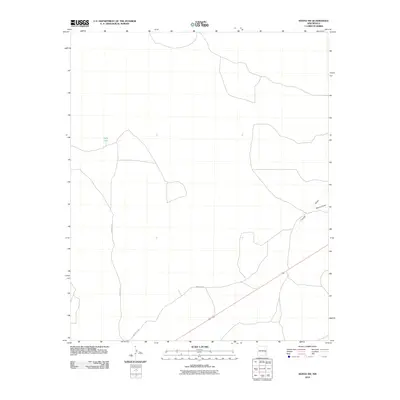
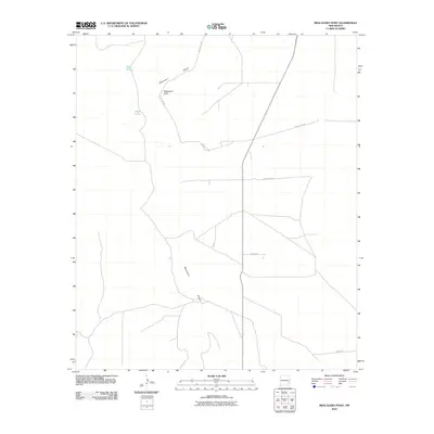
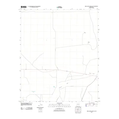
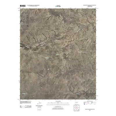
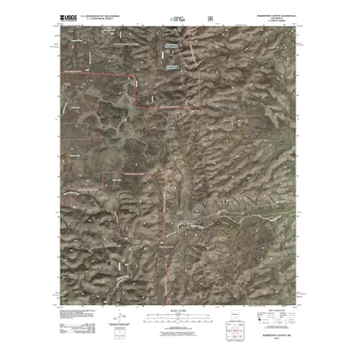
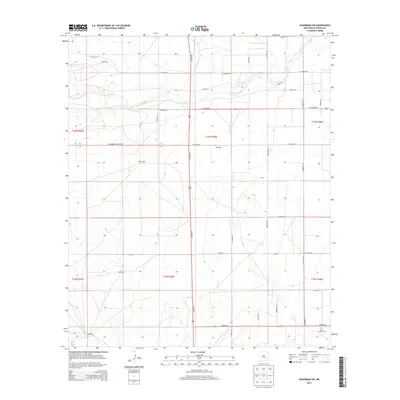
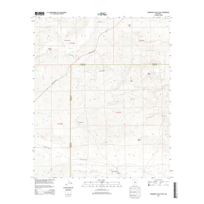
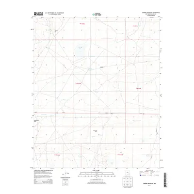
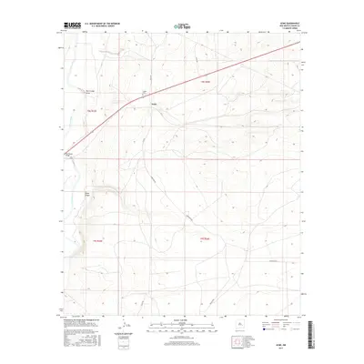
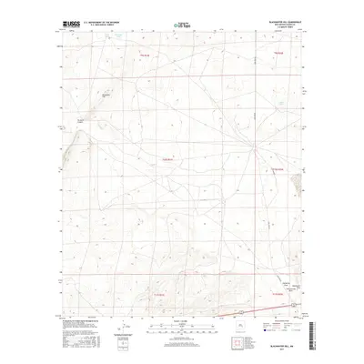
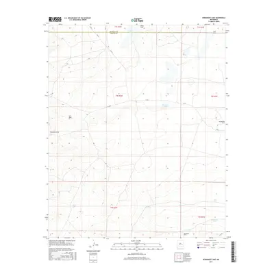
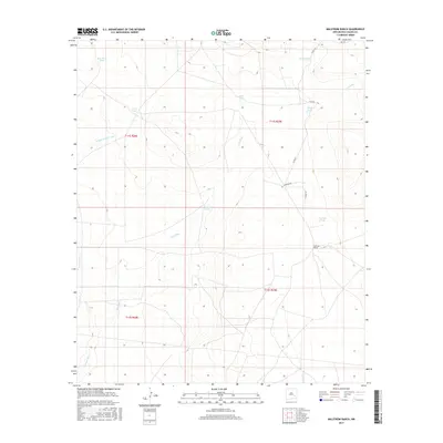
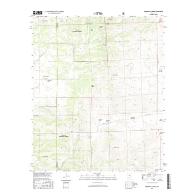
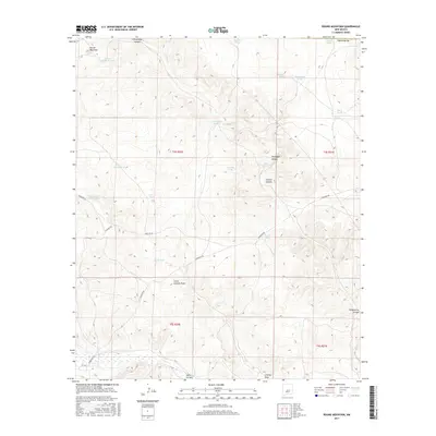
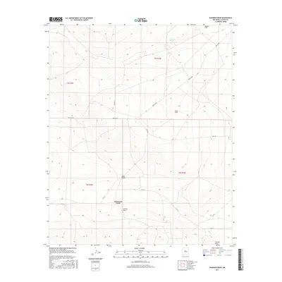
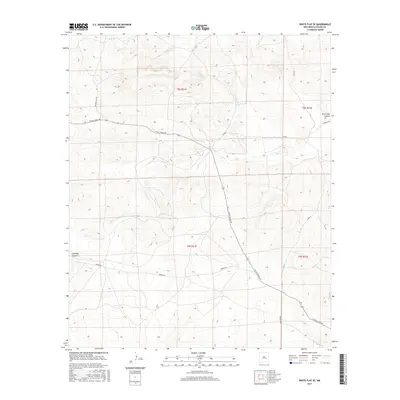
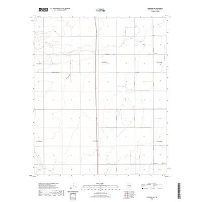
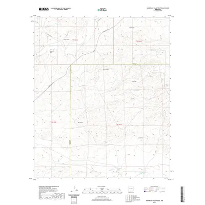
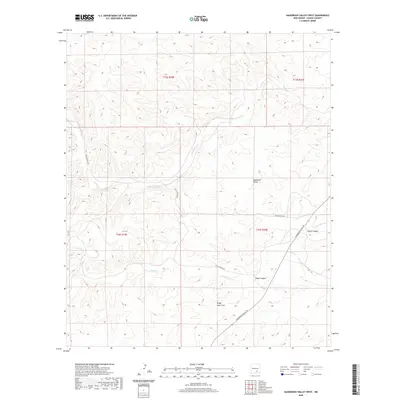
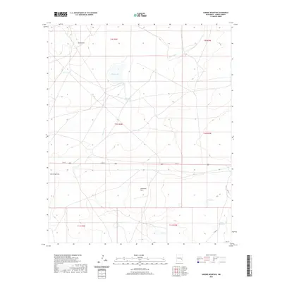
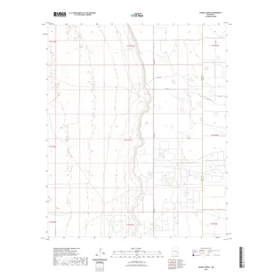
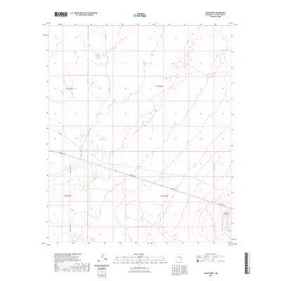
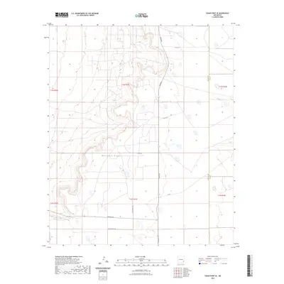
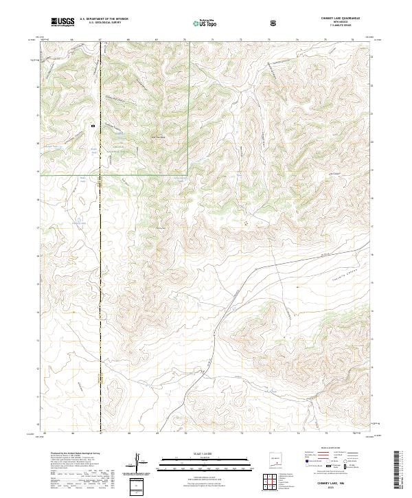
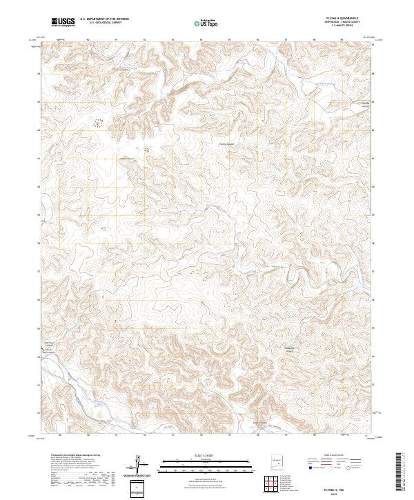
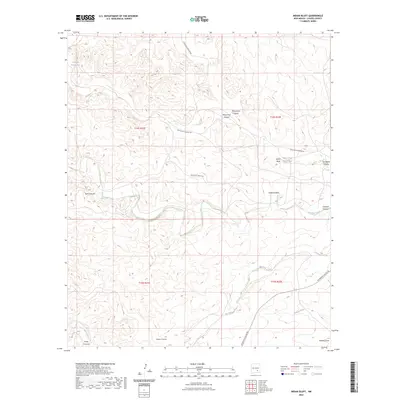
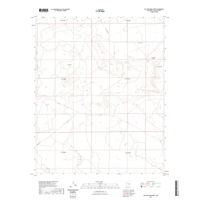
Cato Oil Field dominates the eastern horizon of this Chaves County landscape, where industrial extraction meets a network of ephemeral water bodies and livestock infrastructure. In the late 1970s and early 1980s, the terrain was defined by numerous Oil Wells and a crisscrossing Pipeline system, signifying the region's energy production. Scattered across the plains are vital water resources such as Presler Lake, Broke Tank Lake, and the expansive Red Lake to the west. These basins, along with smaller features like Broke Tank and Cooper Tank, reveal the necessity of water management in an arid environment. The presence of East Camp suggests a concentrated point of activity for ranching or oil field operations, while numerous Drill Holes and Gravel Pits indicate active geotechnical exploration and material extraction during this era.
Find a feature on this map
12 named features on this map. Tap any name to fly to it.
Don’t see what you’re looking for? This feature index may not catch every label — zoom into the map to look around manually.
Map Details
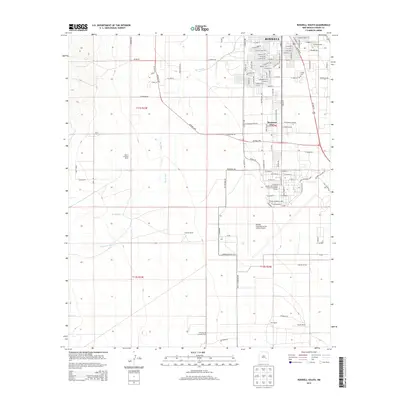
Editions of this 1978 Presler Lake Map
2 editions found
Historical Maps of Chaves County Through Time
584 maps found

1949 Corn Ranch
Chaves County, NM
1949 Hondo Reservoir
Chaves County, NM

1949 Juan Lake
Chaves County, NM
1949 L-E Ranch
Chaves County, NM

1949 Malstrom Ranch
Chaves County, NM
1949 Peters Lake
Chaves County, NM

1949 Roswell North
Chaves County, NM

1949 Roswell South
Chaves County, NM
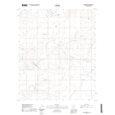
1949 Sardine Mountain
Chaves County, NM
1949 Wade Ranch
Chaves County, NM

1950 Bitter Lake
Chaves County, NM
1950 Bottomless Lakes
Chaves County, NM
1950 Comanche Spring
Chaves County, NM

1950 Corn Ranch
Chaves County, NM
1950 Dexter East
Chaves County, NM
1950 Dexter West
Chaves County, NM

1950 South Spring
Chaves County, NM
1951 Derrick Draw
Chaves County, NM
1951 King Camp
Chaves County, NM
1952 Bar C Bar Ranch
Chaves County, NM
1952 Connor Well
Chaves County, NM
1952 Hagerman SW
Chaves County, NM

1955 Hackberry Ranch
Chaves County, NM

1955 Kincaid Ranch
Chaves County, NM
1956 Diamond A Ranch
Chaves County, NM

1959 Diamond A Ranch
Chaves County, NM
1959 Hackberry Ranch
Chaves County, NM

1960 Teel Ranch
Chaves County, NM
1961 Flying H
Chaves County, NM

1961 Indian Bluff
Chaves County, NM
1962 Acme
Chaves County, NM
1962 Bitter Lake
Chaves County, NM
1962 Dunken
Chaves County, NM
1962 Eightmile Draw
Chaves County, NM

1962 Horseshoe Bend
Chaves County, NM
1962 Marley Draw
Chaves County, NM
1962 Melena
Chaves County, NM
1962 Panther Hill
Chaves County, NM
1962 Rock House Canyon
Chaves County, NM
1962 Roswell North
Chaves County, NM
1962 Roswell South
Chaves County, NM
1962 South Spring
Chaves County, NM
1963 Barn Draw
Chaves County, NM

1963 Cornucopia Canyon
Chaves County, NM
1963 Coyote Draw
Chaves County, NM
1963 Elk
Chaves County, NM
1963 Robertson Canyon
Chaves County, NM
1965 Bullis Spring Ranch
Chaves County, NM
1965 Chimney Lake
Chaves County, NM
1965 Cornucopia Canyon
Chaves County, NM
1965 Lewis Peak
Chaves County, NM
1965 Lewis Peak NE
Chaves County, NM
1965 Pinon Ranch
Chaves County, NM
1967 Campbell
Chaves County, NM
1967 Cottonwood Draw
Chaves County, NM
1967 Deep Well
Chaves County, NM
1967 Deering Place
Chaves County, NM
1967 Denton Camp
Chaves County, NM
1967 Dunlap Sill
Chaves County, NM
1967 Elkins
Chaves County, NM
1967 Haystack Butte
Chaves County, NM
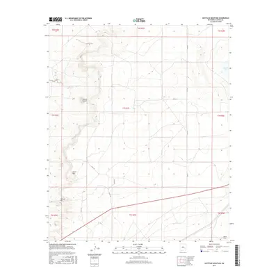
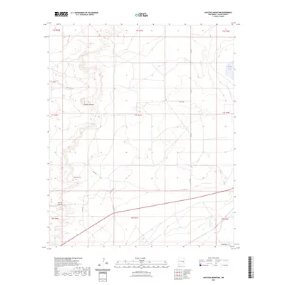
1967 Haystack Mountain
Chaves County, NM
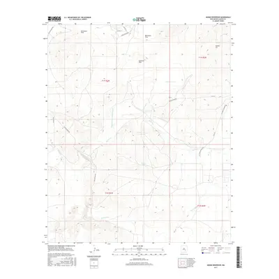
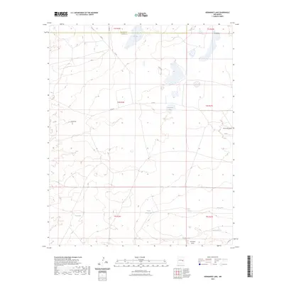
1967 Hernandez Lake
Chaves County, NM
1967 Howell Ranch
Chaves County, NM
1967 Mesa
Chaves County, NM
1967 Mesa SE
Chaves County, NM
1967 Mesa SW
Chaves County, NM
1967 Olive
Chaves County, NM
1967 Round Mountain
Chaves County, NM
1967 Round Mountain SE
Chaves County, NM
1967 Sardine Lake
Chaves County, NM
1967 Shannon Draw
Chaves County, NM
1967 Swallow Nest Canyon
Chaves County, NM
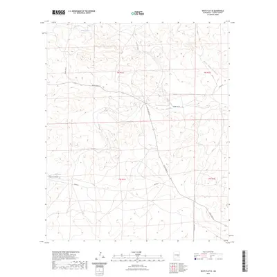
1967 White Flat SE
Chaves County, NM

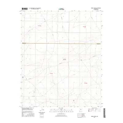
1967 Wire Lake
Chaves County, NM
1973 Caudill Ranch
Chaves County, NM
1973 Cedar Point
Chaves County, NM
1973 Cedar Point SE
Chaves County, NM
1973 Culp Ranch
Chaves County, NM
1973 Mescalero Point
Chaves County, NM
1973 Mescalero Point NE
Chaves County, NM
1973 Oasis
Chaves County, NM
1973 Rippee Ranch
Chaves County, NM
1973 Vest Camp
Chaves County, NM
1978 Curlew Lake
Chaves County, NM

1978 Encino Draw
Chaves County, NM
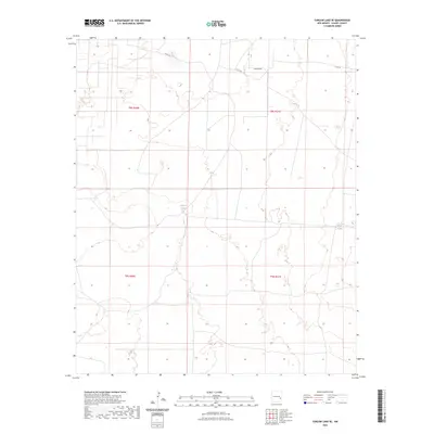
1978 Presler Lake
Chaves County, NM
1978 South Taylor Tank
Chaves County, NM
1979 Button Mesa South
Chaves County, NM
1979 Curlew Lake SE
Chaves County, NM
1979 Kenna
Chaves County, NM
1979 Kenna SW
Chaves County, NM
1979 Lone Wolf
Chaves County, NM

1979 Salt Creek
Chaves County, NM
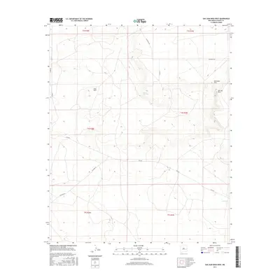
1979 San Juan Mesa West
Chaves County, NM
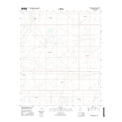
1988 Blackwater Hill
Chaves County, NM
1988 Dark Canyon
Chaves County, NM
1988 Lucky Lake
Chaves County, NM
1989 Dunken
Chaves County, NM
1989 Flying H
Chaves County, NM

1989 Indian Bluff
Chaves County, NM
1989 Loco Canyon
Chaves County, NM
1989 Meadow Hill
Chaves County, NM
1989 Sagebrush Valley East
Chaves County, NM
1989 Sagebrush Valley West
Chaves County, NM
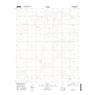
1989 Singer Lake
Chaves County, NM
1989 Sixteenmile Draw West
Chaves County, NM

1989 Thimble Canyon
Chaves County, NM

2001 Bullis Spring Ranch
Chaves County, NM

2001 Pinon Ranch
Chaves County, NM

2001 South Taylor Tank
Chaves County, NM
2004 Chimney Lake
Chaves County, NM
2004 Elk
Chaves County, NM
2004 Robertson Canyon
Chaves County, NM
2010 Acme
Chaves County, NM
2010 Bar C Bar Ranch
Chaves County, NM
2010 Barn Draw
Chaves County, NM
2010 Bitter Lake
Chaves County, NM
2010 Blackwater Hill
Chaves County, NM
2010 Bottomless Lakes
Chaves County, NM
2010 Button Mesa South
Chaves County, NM
2010 Campbell
Chaves County, NM
2010 Caudill Ranch
Chaves County, NM
2010 Cedar Point
Chaves County, NM
2010 Cedar Point SE
Chaves County, NM
2010 Comanche Spring
Chaves County, NM
2010 Connor Well
Chaves County, NM
2010 Corn Ranch
Chaves County, NM
2010 Cornucopia Canyon
Chaves County, NM
2010 Cottonwood Draw
Chaves County, NM
2010 Coyote Draw
Chaves County, NM
2010 Culp Ranch
Chaves County, NM
2010 Curlew Lake
Chaves County, NM
2010 Curlew Lake SE
Chaves County, NM
2010 Dark Canyon
Chaves County, NM
2010 Deep Well
Chaves County, NM
2010 Deering Place
Chaves County, NM
2010 Denton Camp
Chaves County, NM
2010 Derrick Draw
Chaves County, NM
2010 Dexter East
Chaves County, NM
2010 Dexter West
Chaves County, NM
2010 Diamond A Ranch
Chaves County, NM
2010 Dunken
Chaves County, NM
2010 Dunlap Sill
Chaves County, NM
2010 Eightmile Draw
Chaves County, NM
2010 Elkins
Chaves County, NM
2010 Encino Draw
Chaves County, NM
2010 Flying H
Chaves County, NM
2010 Hackberry Ranch
Chaves County, NM
2010 Hagerman SW
Chaves County, NM
2010 Haystack Butte
Chaves County, NM
2010 Haystack Mountain
Chaves County, NM
2010 Hernandez Lake
Chaves County, NM
2010 Hondo Reservoir
Chaves County, NM
2010 Howell Ranch
Chaves County, NM
2010 Indian Bluff
Chaves County, NM
2010 Juan Lake
Chaves County, NM
2010 Kenna
Chaves County, NM
2010 Kenna SW
Chaves County, NM
2010 Kincaid Ranch
Chaves County, NM
2010 King Camp
Chaves County, NM
2010 L E Ranch
Chaves County, NM
2010 Lewis Peak
Chaves County, NM
2010 Lewis Peak NE
Chaves County, NM
2010 Loco Canyon
Chaves County, NM
2010 Lone Wolf
Chaves County, NM
2010 Lucky Lake
Chaves County, NM
2010 Malstrom Ranch
Chaves County, NM
2010 Marley Draw
Chaves County, NM
2010 Meadow Hill
Chaves County, NM
2010 Melena
Chaves County, NM
2010 Mesa
Chaves County, NM
2010 Mesa SE
Chaves County, NM
2010 Mesa SW
Chaves County, NM
2010 Mescalero Point
Chaves County, NM
2010 Mescalero Point NE
Chaves County, NM
2010 Oasis
Chaves County, NM
2010 Olive
Chaves County, NM
2010 Panther Hill
Chaves County, NM
2010 Peters Lake
Chaves County, NM
2010 Presler Lake
Chaves County, NM
2010 Rippee Ranch
Chaves County, NM
2010 Rock House Canyon
Chaves County, NM
2010 Roswell North
Chaves County, NM
2010 Roswell South
Chaves County, NM
2010 Round Mountain
Chaves County, NM
2010 Round Mountain SE
Chaves County, NM
2010 Sagebrush Valley East
Chaves County, NM
2010 Sagebrush Valley West
Chaves County, NM
2010 San Juan Mesa West
Chaves County, NM
2010 Sardine Lake
Chaves County, NM
2010 Sardine Mountain
Chaves County, NM
2010 Shannon Draw
Chaves County, NM
2010 Singer Lake
Chaves County, NM
2010 Sixteenmile Draw West
Chaves County, NM
2010 South Spring
Chaves County, NM
2010 Swallow Nest Canyon
Chaves County, NM
2010 Thimble Canyon
Chaves County, NM
2010 Vest Camp
Chaves County, NM
2010 Wade Ranch
Chaves County, NM
2010 White Flat SE
Chaves County, NM
2010 Wire Lake
Chaves County, NM
2011 Bullis Spring Ranch
Chaves County, NM
2011 Chimney Lake
Chaves County, NM
2011 Elk
Chaves County, NM
2011 Pinon Ranch
Chaves County, NM
2011 Robertson Canyon
Chaves County, NM
2011 South Taylor Tank
Chaves County, NM
2013 Acme
Chaves County, NM
2013 Bar C Bar Ranch
Chaves County, NM
2013 Barn Draw
Chaves County, NM
2013 Bitter Lake
Chaves County, NM
2013 Blackwater Hill
Chaves County, NM
2013 Bottomless Lakes
Chaves County, NM
2013 Bullis Spring Ranch
Chaves County, NM
2013 Button Mesa South
Chaves County, NM
2013 Campbell
Chaves County, NM
2013 Caudill Ranch
Chaves County, NM
2013 Cedar Point
Chaves County, NM
2013 Cedar Point SE
Chaves County, NM
2013 Chimney Lake
Chaves County, NM
2013 Comanche Spring
Chaves County, NM
2013 Connor Well
Chaves County, NM
2013 Corn Ranch
Chaves County, NM
2013 Cornucopia Canyon
Chaves County, NM
2013 Cottonwood Draw
Chaves County, NM
2013 Coyote Draw
Chaves County, NM
2013 Culp Ranch
Chaves County, NM
2013 Curlew Lake
Chaves County, NM
2013 Curlew Lake SE
Chaves County, NM
2013 Dark Canyon
Chaves County, NM
2013 Deep Well
Chaves County, NM
2013 Deering Place
Chaves County, NM
2013 Denton Camp
Chaves County, NM
2013 Derrick Draw
Chaves County, NM
2013 Dexter East
Chaves County, NM
2013 Dexter West
Chaves County, NM
2013 Diamond A Ranch
Chaves County, NM
2013 Dunken
Chaves County, NM
2013 Dunlap Sill
Chaves County, NM
2013 Eightmile Draw
Chaves County, NM
2013 Elk
Chaves County, NM
2013 Elkins
Chaves County, NM
2013 Encino Draw
Chaves County, NM
2013 Flying H
Chaves County, NM
2013 Hackberry Ranch
Chaves County, NM
2013 Hagerman SW
Chaves County, NM
2013 Haystack Butte
Chaves County, NM
2013 Haystack Mountain
Chaves County, NM
2013 Hernandez Lake
Chaves County, NM
2013 Hondo Reservoir
Chaves County, NM
2013 Howell Ranch
Chaves County, NM
2013 Indian Bluff
Chaves County, NM
2013 Juan Lake
Chaves County, NM
2013 Kenna
Chaves County, NM
2013 Kenna SW
Chaves County, NM
2013 Kincaid Ranch
Chaves County, NM
2013 King Camp
Chaves County, NM
2013 L E Ranch
Chaves County, NM
2013 Lewis Peak
Chaves County, NM
2013 Lewis Peak NE
Chaves County, NM
2013 Loco Canyon
Chaves County, NM
2013 Lone Wolf
Chaves County, NM
2013 Lucky Lake
Chaves County, NM
2013 Malstrom Ranch
Chaves County, NM
2013 Marley Draw
Chaves County, NM
2013 Meadow Hill
Chaves County, NM
2013 Melena
Chaves County, NM
2013 Mesa
Chaves County, NM
2013 Mesa SE
Chaves County, NM
2013 Mesa SW
Chaves County, NM
2013 Mescalero Point
Chaves County, NM
2013 Mescalero Point NE
Chaves County, NM
2013 Oasis
Chaves County, NM
2013 Olive
Chaves County, NM
2013 Panther Hill
Chaves County, NM
2013 Peters Lake
Chaves County, NM
2013 Pinon Ranch
Chaves County, NM
2013 Presler Lake
Chaves County, NM
2013 Rippee Ranch
Chaves County, NM
2013 Robertson Canyon
Chaves County, NM
2013 Rock House Canyon
Chaves County, NM
2013 Roswell North
Chaves County, NM
2013 Roswell South
Chaves County, NM
2013 Round Mountain
Chaves County, NM
2013 Round Mountain SE
Chaves County, NM
2013 Sagebrush Valley East
Chaves County, NM
2013 Sagebrush Valley West
Chaves County, NM
2013 San Juan Mesa West
Chaves County, NM
2013 Sardine Lake
Chaves County, NM
2013 Sardine Mountain
Chaves County, NM
2013 Shannon Draw
Chaves County, NM
2013 Singer Lake
Chaves County, NM
2013 Sixteenmile Draw West
Chaves County, NM
2013 South Spring
Chaves County, NM
2013 South Taylor Tank
Chaves County, NM
2013 Swallow Nest Canyon
Chaves County, NM
2013 Thimble Canyon
Chaves County, NM
2013 Vest Camp
Chaves County, NM
2013 Wade Ranch
Chaves County, NM
2013 White Flat SE
Chaves County, NM
2013 Wire Lake
Chaves County, NM
2017 Acme
Chaves County, NM
2017 Bar C Bar Ranch
Chaves County, NM
2017 Barn Draw
Chaves County, NM
2017 Bitter Lake
Chaves County, NM
2017 Blackwater Hill
Chaves County, NM
2017 Bottomless Lakes
Chaves County, NM
2017 Bullis Spring Ranch
Chaves County, NM
2017 Button Mesa South
Chaves County, NM
2017 Campbell
Chaves County, NM
2017 Caudill Ranch
Chaves County, NM
2017 Cedar Point
Chaves County, NM
2017 Cedar Point SE
Chaves County, NM
2017 Chimney Lake
Chaves County, NM
2017 Comanche Spring
Chaves County, NM
2017 Connor Well
Chaves County, NM
2017 Corn Ranch
Chaves County, NM
2017 Cornucopia Canyon
Chaves County, NM
2017 Cottonwood Draw
Chaves County, NM
2017 Coyote Draw
Chaves County, NM
2017 Culp Ranch
Chaves County, NM
2017 Curlew Lake
Chaves County, NM
2017 Curlew Lake SE
Chaves County, NM
2017 Dark Canyon
Chaves County, NM
2017 Deep Well
Chaves County, NM
2017 Deering Place
Chaves County, NM
2017 Denton Camp
Chaves County, NM
2017 Derrick Draw
Chaves County, NM
2017 Dexter East
Chaves County, NM
2017 Dexter West
Chaves County, NM
2017 Diamond A Ranch
Chaves County, NM
2017 Dunken
Chaves County, NM
2017 Dunlap Sill
Chaves County, NM
2017 Eightmile Draw
Chaves County, NM
2017 Elk
Chaves County, NM
2017 Elkins
Chaves County, NM
2017 Encino Draw
Chaves County, NM
2017 Flying H
Chaves County, NM
2017 Hackberry Ranch
Chaves County, NM
2017 Hagerman SW
Chaves County, NM
2017 Haystack Butte
Chaves County, NM
2017 Haystack Mountain
Chaves County, NM
2017 Hernandez Lake
Chaves County, NM
2017 Hondo Reservoir
Chaves County, NM
2017 Howell Ranch
Chaves County, NM
2017 Indian Bluff
Chaves County, NM
2017 Juan Lake
Chaves County, NM
2017 Kenna
Chaves County, NM
2017 Kenna SW
Chaves County, NM
2017 Kincaid Ranch
Chaves County, NM
2017 King Camp
Chaves County, NM
2017 L E Ranch
Chaves County, NM
2017 Lewis Peak
Chaves County, NM
2017 Lewis Peak NE
Chaves County, NM
2017 Loco Canyon
Chaves County, NM
2017 Lone Wolf
Chaves County, NM
2017 Lucky Lake
Chaves County, NM
2017 Malstrom Ranch
Chaves County, NM
2017 Marley Draw
Chaves County, NM
2017 Meadow Hill
Chaves County, NM
2017 Melena
Chaves County, NM
2017 Mesa
Chaves County, NM
2017 Mesa SE
Chaves County, NM
2017 Mesa SW
Chaves County, NM
2017 Mescalero Point
Chaves County, NM
2017 Mescalero Point NE
Chaves County, NM
2017 Oasis
Chaves County, NM
2017 Olive
Chaves County, NM
2017 Panther Hill
Chaves County, NM
2017 Peters Lake
Chaves County, NM
2017 Pinon Ranch
Chaves County, NM
2017 Presler Lake
Chaves County, NM
2017 Rippee Ranch
Chaves County, NM
2017 Robertson Canyon
Chaves County, NM
2017 Rock House Canyon
Chaves County, NM
2017 Roswell North
Chaves County, NM
2017 Roswell South
Chaves County, NM
2017 Round Mountain
Chaves County, NM
2017 Round Mountain SE
Chaves County, NM
2017 Sagebrush Valley East
Chaves County, NM
2017 Sagebrush Valley West
Chaves County, NM
2017 San Juan Mesa West
Chaves County, NM
2017 Sardine Lake
Chaves County, NM
2017 Sardine Mountain
Chaves County, NM
2017 Shannon Draw
Chaves County, NM
2017 Singer Lake
Chaves County, NM
2017 Sixteenmile Draw West
Chaves County, NM
2017 South Spring
Chaves County, NM
2017 South Taylor Tank
Chaves County, NM
2017 Swallow Nest Canyon
Chaves County, NM
2017 Thimble Canyon
Chaves County, NM
2017 Vest Camp
Chaves County, NM
2017 Wade Ranch
Chaves County, NM
2017 White Flat SE
Chaves County, NM
2017 Wire Lake
Chaves County, NM
2020 Acme
Chaves County, NM
2020 Bar C Bar Ranch
Chaves County, NM
2020 Barn Draw
Chaves County, NM
2020 Bitter Lake
Chaves County, NM
2020 Blackwater Hill
Chaves County, NM
2020 Bottomless Lakes
Chaves County, NM
2020 Bullis Spring Ranch
Chaves County, NM
2020 Button Mesa South
Chaves County, NM
2020 Campbell
Chaves County, NM
2020 Caudill Ranch
Chaves County, NM
2020 Cedar Point
Chaves County, NM
2020 Cedar Point SE
Chaves County, NM
2020 Chimney Lake
Chaves County, NM
2020 Comanche Spring
Chaves County, NM
2020 Connor Well
Chaves County, NM
2020 Corn Ranch
Chaves County, NM
2020 Cornucopia Canyon
Chaves County, NM
2020 Cottonwood Draw
Chaves County, NM
2020 Coyote Draw
Chaves County, NM
2020 Culp Ranch
Chaves County, NM
2020 Curlew Lake
Chaves County, NM
2020 Curlew Lake SE
Chaves County, NM
2020 Dark Canyon
Chaves County, NM
2020 Deep Well
Chaves County, NM
2020 Deering Place
Chaves County, NM
2020 Denton Camp
Chaves County, NM
2020 Derrick Draw
Chaves County, NM
2020 Dexter East
Chaves County, NM
2020 Dexter West
Chaves County, NM
2020 Diamond A Ranch
Chaves County, NM
2020 Dunken
Chaves County, NM
2020 Dunlap Sill
Chaves County, NM
2020 Eightmile Draw
Chaves County, NM
2020 Elk
Chaves County, NM
2020 Elkins
Chaves County, NM
2020 Encino Draw
Chaves County, NM
2020 Flying H
Chaves County, NM
2020 Hackberry Ranch
Chaves County, NM
2020 Hagerman SW
Chaves County, NM
2020 Haystack Butte
Chaves County, NM
2020 Haystack Mountain
Chaves County, NM
2020 Hernandez Lake
Chaves County, NM
2020 Hondo Reservoir
Chaves County, NM
2020 Howell Ranch
Chaves County, NM
2020 Indian Bluff
Chaves County, NM
2020 Juan Lake
Chaves County, NM
2020 Kenna
Chaves County, NM
2020 Kenna SW
Chaves County, NM
2020 Kincaid Ranch
Chaves County, NM
2020 King Camp
Chaves County, NM
2020 L E Ranch
Chaves County, NM
2020 Lewis Peak
Chaves County, NM
2020 Lewis Peak NE
Chaves County, NM
2020 Loco Canyon
Chaves County, NM
2020 Lone Wolf
Chaves County, NM
2020 Lucky Lake
Chaves County, NM
2020 Malstrom Ranch
Chaves County, NM
2020 Marley Draw
Chaves County, NM
2020 Meadow Hill
Chaves County, NM
2020 Melena
Chaves County, NM
2020 Mesa
Chaves County, NM
2020 Mesa SE
Chaves County, NM
2020 Mesa SW
Chaves County, NM
2020 Mescalero Point
Chaves County, NM
2020 Mescalero Point NE
Chaves County, NM
2020 Oasis
Chaves County, NM
2020 Olive
Chaves County, NM
2020 Panther Hill
Chaves County, NM
2020 Peters Lake
Chaves County, NM
2020 Pinon Ranch
Chaves County, NM
2020 Presler Lake
Chaves County, NM
2020 Rippee Ranch
Chaves County, NM
2020 Robertson Canyon
Chaves County, NM
2020 Rock House Canyon
Chaves County, NM
2020 Roswell North
Chaves County, NM
2020 Roswell South
Chaves County, NM
2020 Round Mountain
Chaves County, NM
2020 Round Mountain SE
Chaves County, NM
2020 Sagebrush Valley East
Chaves County, NM
2020 Sagebrush Valley West
Chaves County, NM
2020 San Juan Mesa West
Chaves County, NM
2020 Sardine Lake
Chaves County, NM
2020 Sardine Mountain
Chaves County, NM
2020 Shannon Draw
Chaves County, NM
2020 Singer Lake
Chaves County, NM
2020 Sixteenmile Draw West
Chaves County, NM
2020 South Spring
Chaves County, NM
2020 South Taylor Tank
Chaves County, NM
2020 Swallow Nest Canyon
Chaves County, NM
2020 Thimble Canyon
Chaves County, NM
2020 Vest Camp
Chaves County, NM
2020 Wade Ranch
Chaves County, NM
2020 White Flat SE
Chaves County, NM
2020 Wire Lake
Chaves County, NM
2023 Acme
Chaves County, NM
2023 Bar C Bar Ranch
Chaves County, NM
2023 Barn Draw
Chaves County, NM
2023 Bitter Lake
Chaves County, NM
2023 Blackwater Hill
Chaves County, NM
2023 Bottomless Lakes
Chaves County, NM
2023 Bullis Spring Ranch
Chaves County, NM
2023 Button Mesa South
Chaves County, NM
2023 Campbell
Chaves County, NM
2023 Caudill Ranch
Chaves County, NM
2023 Cedar Point
Chaves County, NM
2023 Cedar Point SE
Chaves County, NM
2023 Chimney Lake
Chaves County, NM
2023 Comanche Spring
Chaves County, NM
2023 Connor Well
Chaves County, NM
2023 Corn Ranch
Chaves County, NM
2023 Cornucopia Canyon
Chaves County, NM
2023 Cottonwood Draw
Chaves County, NM
2023 Coyote Draw
Chaves County, NM
2023 Culp Ranch
Chaves County, NM
2023 Curlew Lake
Chaves County, NM
2023 Curlew Lake SE
Chaves County, NM
2023 Dark Canyon
Chaves County, NM
2023 Deep Well
Chaves County, NM
2023 Deering Place
Chaves County, NM
2023 Denton Camp
Chaves County, NM
2023 Derrick Draw
Chaves County, NM
2023 Dexter East
Chaves County, NM
2023 Dexter West
Chaves County, NM
2023 Diamond A Ranch
Chaves County, NM
2023 Dunken
Chaves County, NM
2023 Dunlap Sill
Chaves County, NM
2023 Eightmile Draw
Chaves County, NM
2023 Elk
Chaves County, NM
2023 Elkins
Chaves County, NM
2023 Encino Draw
Chaves County, NM
2023 Flying H
Chaves County, NM
2023 Hackberry Ranch
Chaves County, NM
2023 Hagerman SW
Chaves County, NM
2023 Haystack Butte
Chaves County, NM
2023 Haystack Mountain
Chaves County, NM
2023 Hernandez Lake
Chaves County, NM
2023 Hondo Reservoir
Chaves County, NM
2023 Howell Ranch
Chaves County, NM
2023 Indian Bluff
Chaves County, NM
2023 Juan Lake
Chaves County, NM
2023 Kenna
Chaves County, NM
2023 Kenna SW
Chaves County, NM
2023 Kincaid Ranch
Chaves County, NM
2023 King Camp
Chaves County, NM
2023 L E Ranch
Chaves County, NM
2023 Lewis Peak
Chaves County, NM
2023 Lewis Peak NE
Chaves County, NM
2023 Loco Canyon
Chaves County, NM
2023 Lone Wolf
Chaves County, NM
2023 Lucky Lake
Chaves County, NM
2023 Malstrom Ranch
Chaves County, NM
2023 Marley Draw
Chaves County, NM
2023 Meadow Hill
Chaves County, NM
2023 Melena
Chaves County, NM
2023 Mesa
Chaves County, NM
2023 Mesa SE
Chaves County, NM
2023 Mesa SW
Chaves County, NM
2023 Mescalero Point
Chaves County, NM
2023 Mescalero Point NE
Chaves County, NM
2023 Oasis
Chaves County, NM
2023 Olive
Chaves County, NM
2023 Panther Hill
Chaves County, NM
2023 Peters Lake
Chaves County, NM
2023 Pinon Ranch
Chaves County, NM
2023 Presler Lake
Chaves County, NM
2023 Rippee Ranch
Chaves County, NM
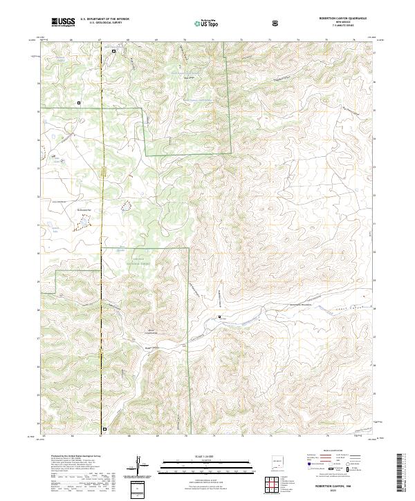
2023 Robertson Canyon
Chaves County, NM
2023 Rock House Canyon
Chaves County, NM
2023 Roswell North
Chaves County, NM
2023 Roswell South
Chaves County, NM
2023 Round Mountain
Chaves County, NM
2023 Round Mountain SE
Chaves County, NM
2023 Sagebrush Valley East
Chaves County, NM
2023 Sagebrush Valley West
Chaves County, NM
2023 San Juan Mesa West
Chaves County, NM
2023 Sardine Lake
Chaves County, NM
2023 Sardine Mountain
Chaves County, NM
2023 Shannon Draw
Chaves County, NM
2023 Singer Lake
Chaves County, NM
2023 Sixteenmile Draw West
Chaves County, NM
2023 South Spring
Chaves County, NM
2023 South Taylor Tank
Chaves County, NM
2023 Swallow Nest Canyon
Chaves County, NM
2023 Thimble Canyon
Chaves County, NM
2023 Vest Camp
Chaves County, NM
2023 Wade Ranch
Chaves County, NM
2023 White Flat SE
Chaves County, NM
2023 Wire Lake
Chaves County, NM