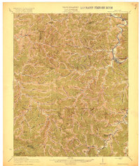
1918 Map of Prestonsburg
USGS Topo · Published 1918About this map
Prestonsburg sits as the central hub of this Eastern Kentucky landscape, situated along the winding banks of the Levisa Fork. In the years following the 1915 survey, the region shows a transition toward organized coal extraction and transit, evidenced by the Chesapeake and Ohio railway tracing the river valley and the operation of Cliff Mine. Away from the main river corridor, the geography is defined by a dense network of hollows and ridges, where remote post offices like Dinwood Alphoretta PO and Maytown Langley PO served isolated rural communities. The map captures local landmarks like Big Lick School and the headwaters of the Licking River, providing a clear picture of Floyd County's settlement patterns before modern highway expansion altered the traditional paths through the gaps and branches.
Find a feature on this map
31 named features on this map. Tap any name to fly to it.
Don’t see what you’re looking for? This feature index may not catch every label — zoom into the map to look around manually.
Map Details
Editions of this 1918 Prestonsburg Map
3 editions found

Other maps of this area

1886 · Prestonsburg
USGS Topo · 1:125,000

1889 · Salyersville
USGS Topo · 1:125,000

1890 · Whitesburg
USGS Topo · 1:125,000

1891 · Hazard
USGS Topo · 1:125,000

1891 · Salyersville
USGS Topo · 1:125,000

1892 · Whitesburg
USGS Topo · 1:125,000

1892 · Prestonsburg
USGS Topo · 1:125,000

1899 · Salyersville
USGS Topo · 1:125,000

1912 · Hindman
USGS Topo · 1:48,000

1914 · Laynesville
USGS Topo · 1:48,000